Introduction
Note: This event requires the latest version (4.3.10) of the Run2gather App. Please download it from (IOS / Android)
Event period has been extended to 28/2/2026.
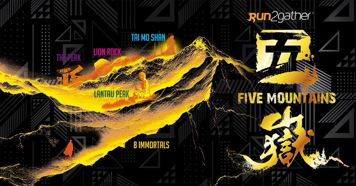
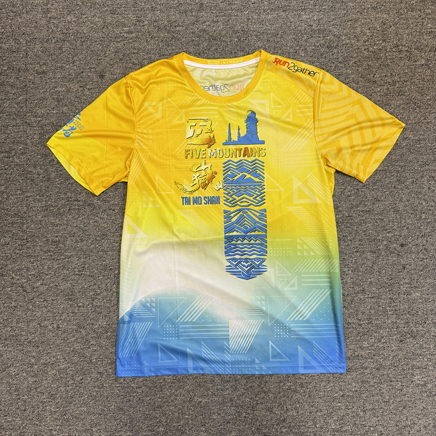
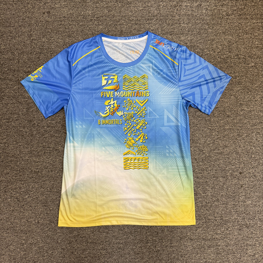
The Five Peaks of Hong Kong is the collective name for the five famous mountains in Hong Kong, namely Lion Rock, Victoria Peak, Pat Sin Leng, Lantau Peak and Tai Mo Shan. Although these five mountains are not the top five highest peaks in Hong Kong, they are probably the most familiar to people.
We will launch a new way of playing, with the R2 App's fixed-point check-in and scoring function, participants can choose their own route within the specified time to check in and score points! Running fast does not necessarily mean winning, the key to victory lies in how you plan your route to get high scores within the time limit. It is a comprehensive competition of physical and mental strength. Do you dare to challenge it?
How to play:
Each substation will have a specific starting point, and participants need to start the R2 App at the designated starting point for timing. Each substation will have a starting point and 14 scoring points. Participants need to plan their own routes within the specified time to go to different scoring points to grab points. Participants need to use the R2 App to check in and earn points. They also need to upload a screenshot with the date, distance and route map and enter the completion time for reference. The system will automatically record the participant's check-in time and score and stop the check-in function after the time limit. Participants are ranked according to their scores and the shorter usage time.
Calculated Grade Level:
The total score of each station is 1500 points. The scores obtained by the contestants within the specified time limit will be divided into the following levels:
- Below 500 points: Bronze
- 500 – 999 points: Silver
- 1000 points and above: Gold
- 1200 points or more: Elite Finisher
Substation:
| Substation | Time Limit |
|---|---|
| Lion Rock | 180 mins |
| Lantau Peak | 240 mins |
| Tai Mo Shan | 240 mins |
| Victoria Peak | 180 mins |
| Pat Sin Leng | 240 mins |
Checkpoint List
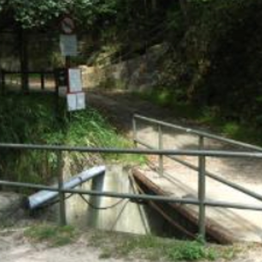
獅子山公園 (起點)
Lion Rock Park (Starting point)
Points: 10
Remark: START
Map Location: View Map
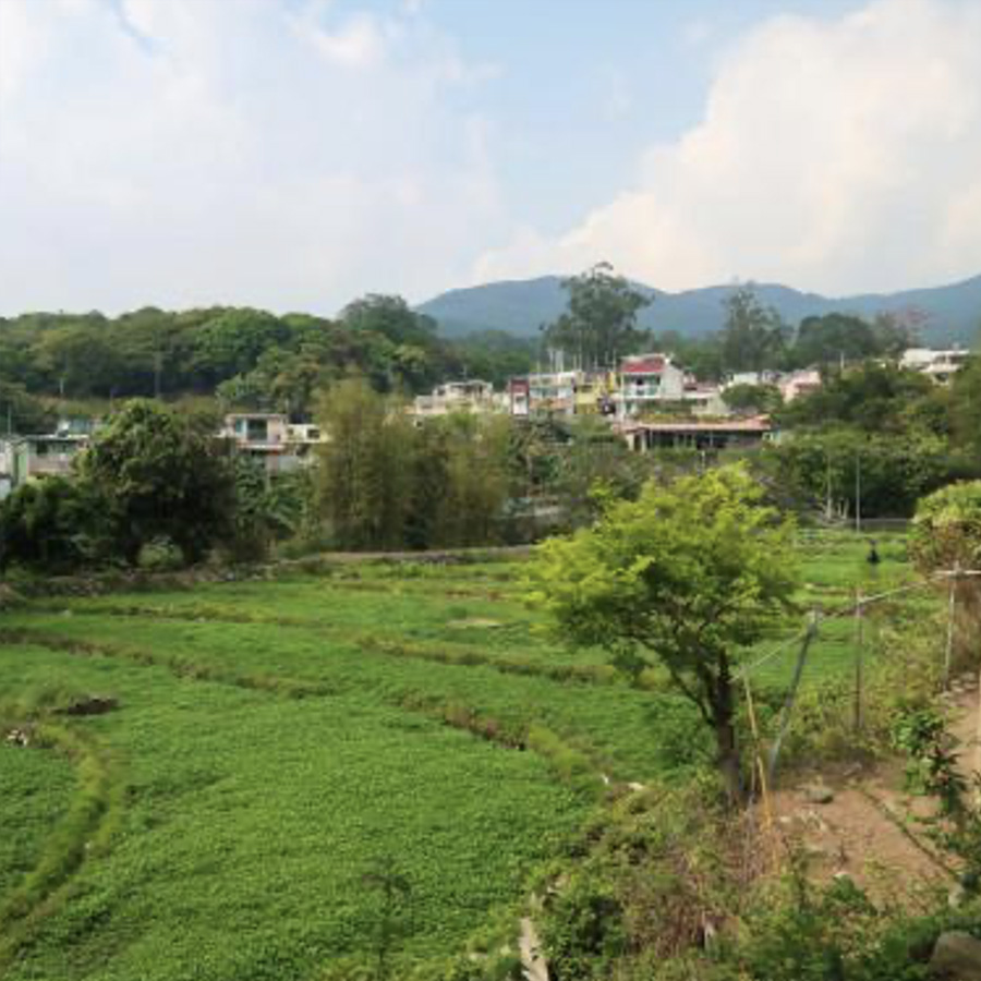
Lion Rock Park is located at Chuk Yuen Road, Wong Tai Sin, Kowloon, and was completed in May 1966. The park covers an area of about 5.07 hectares, with more than 300 trees and other shrubs, about 130 plant species. The park provides 26 barbecue pits with dining tables and chairs for the public to use, as well as children's playgrounds, elderly fitness areas, pebble paths, community gardens and nature conservation areas.
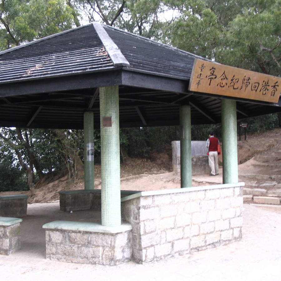
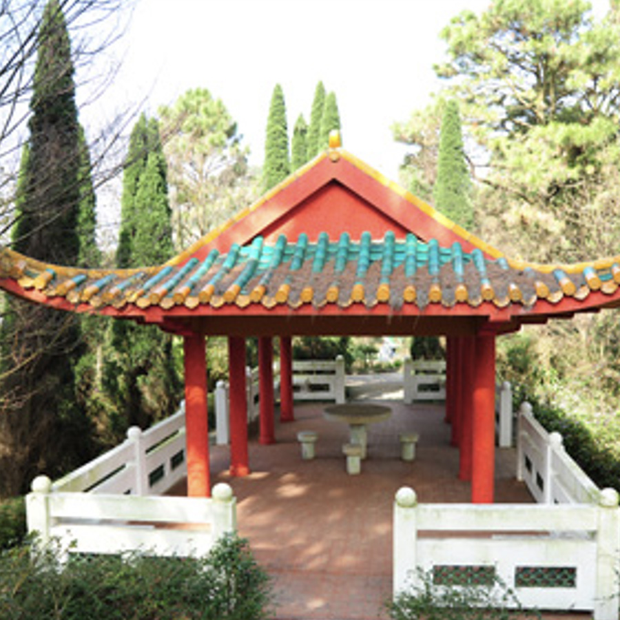
回歸亭
Reunification Pavilion
Points: 40
Map Location: View Map
In 1997, the Agriculture, Fisheries and Conservation Department converted a rain shelter in Kowloon Au into the Hong Kong Handover Memorial Pavilion to commemorate Reunification Pavilion. The pavilion also has an inscription by the then Chief Executive of Hong Kong, Tung Chee-hwa.
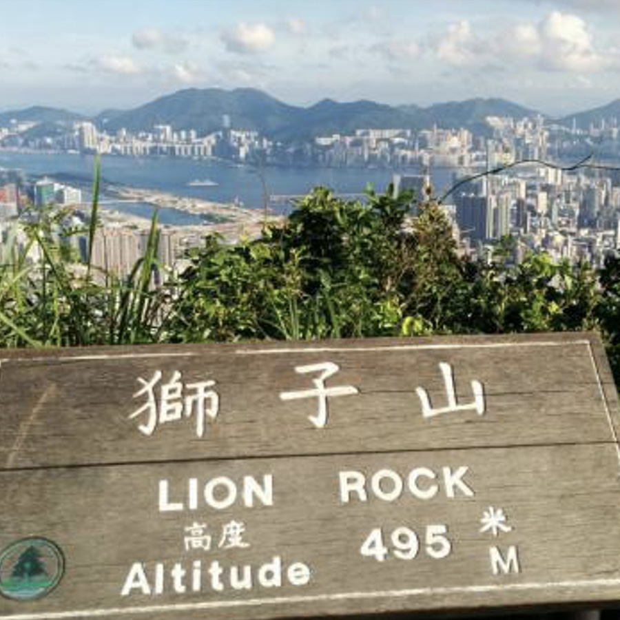
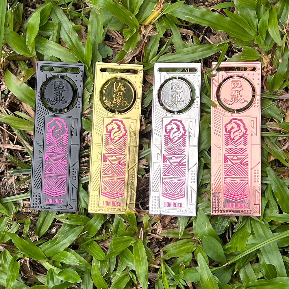
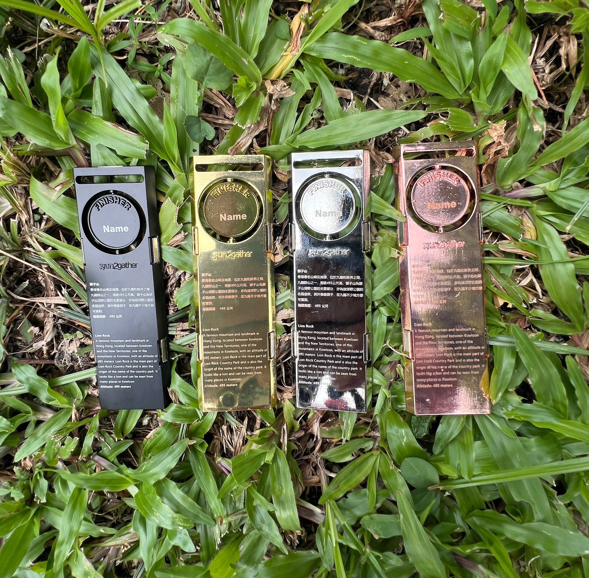
獅子山頂
Lion Rock peak
Points: 250
Map Location: View Map
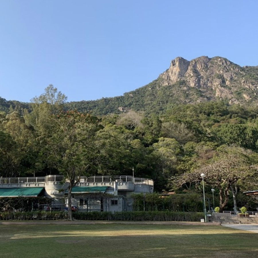
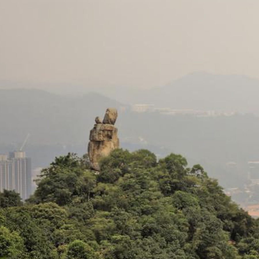
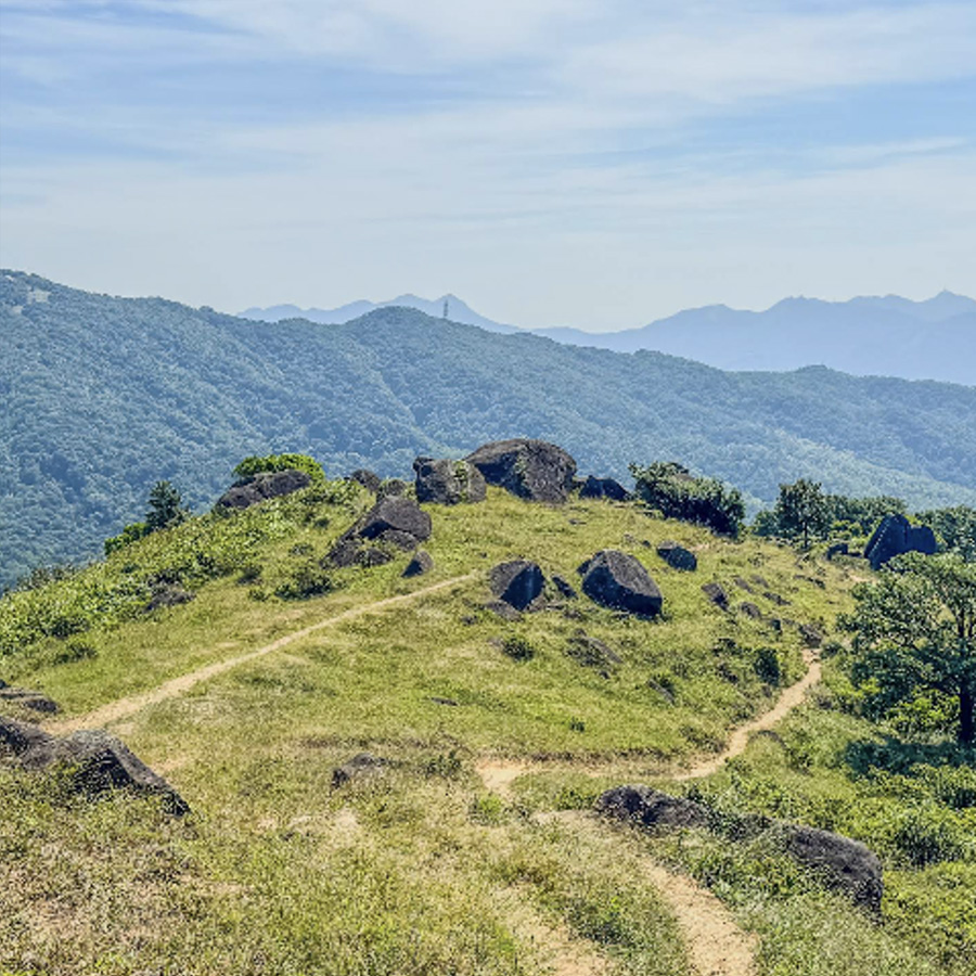
Lion Rock is a famous mountain and landmark in Hong Kong. It is located between Kowloon and the New Territories. It is one of the mountains in Kowloon and has an altitude of 495 meters. Lion Rock is the main part of Lion Rock Country Park and is also the origin of the name of the country park. It looks like a lion and can be seen from many places in Kowloon.
望夫石
Amah Rock
Points: 75
Map Location: View Map
The big rock on the mountain peak is about 15 meters high and looks like a human body. There are two rocks on the big rock, one large and one thin, standing side by side, shaped like a woman carrying a child. The neck of the "mother" and the "child" are formed by horizontal joints of the rock, while the body is formed by vertical joints. The mother and child stand on the mountain peak, overlooking the Shing Mun River in Shatin District and Shatin New Town. The Husband-Watching Rock is slightly bent and motionless, revealing hope. The Husband-Watching Rock is a tourist hotspot in this area and a frequent place for Hong Kong people to go hiking.
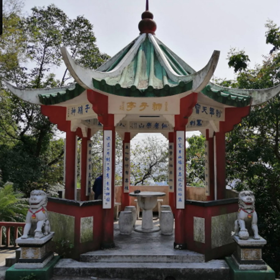
慈雲山獅子亭
Temple Hill Lion's Pavilion
Points: 50
Map Location: View Map
The Lion Pavilion (also known as Shatin Pass Lion Pavilion) beside Shatin Pass Road in Shatin Pass, Shatin District, Hong Kong (near Wong Tai Sin District, Kowloon Peninsula, but its location belongs to Shatin District in terms of administrative division) is part of the Peninsula Lion Park and has been renovated in recent years. There are two stone lions in front of the pavilion. From the pavilion, you can overlook the Kowloon Peninsula, but because the trees in front of the pavilion are growing taller and taller, the pavilion is no longer an ideal place for viewing.
獅子山衞奕信徑 5段涼亭
Lion Rock Wilson Trail Section 5 Pavilion
Points: 75
Map Location: View Map
The Pavilion is one of The District Minor Works (DMW) programme which to improve local facilities, living environment and hygienic conditions in the territory. It covers minor building works, fitting out works and minor alterations, additions and improvement works including furniture and equipment replacement incidental to such works, and slope inspections and minor slope improvement works in respect of all the district facilities under the Home Affairs Department (HAD) and the Leisure and Cultural Services Department (LCSD).
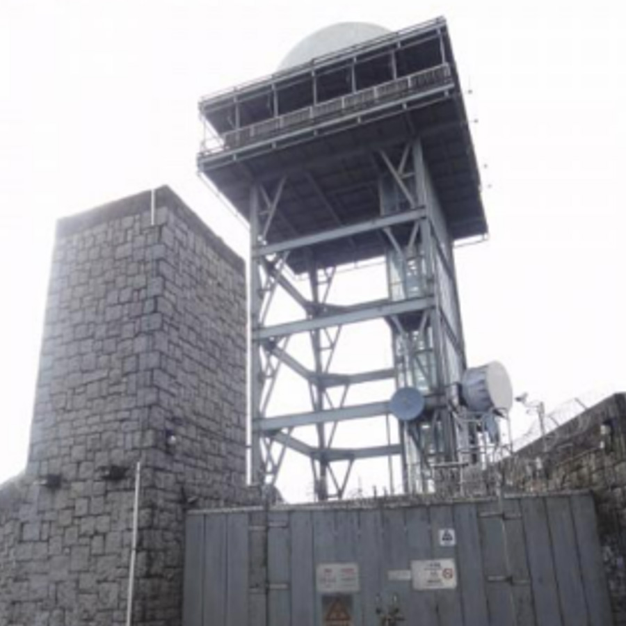
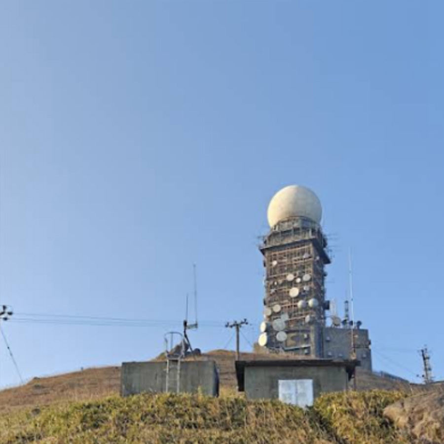
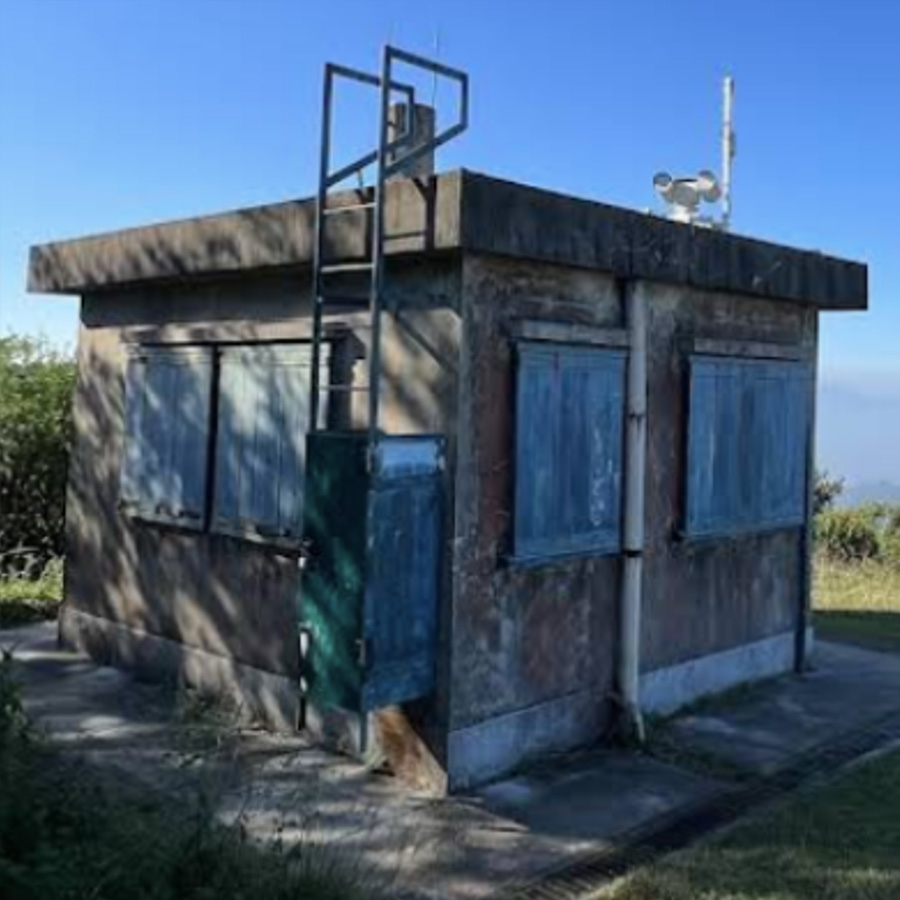
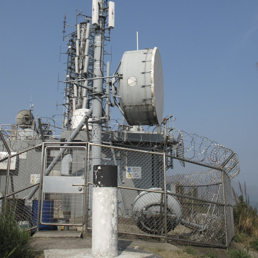
民航處筆架山進場着陸二次監察雷達站
Beacon Hill Approach Secondary Surveillance Radar Station
Points: 150
Map Location: View Map
There is a Civil Aviation Department radar station at the top of Beacon Hill, which assists the airport in directing air traffic. There is also a driveway (Lung Yan Road) to facilitate maintenance personnel to go up the hill.
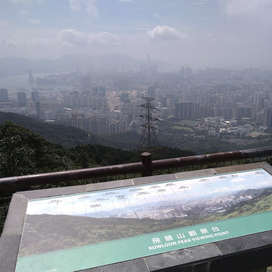
飛鵝山觀景台
Kowloon Peak Viewing Point
Points: 75
Map Location: View Map
Many TV programs were filmed at the Fei Ngo Shan Observation Deck near Dong Shan, north of Fei Ngo Shan. For example, the album cover of the famous singer Alan Tam's "The Root of Love" released in 1984 was also filmed here. The MTV of Fang Liying's song Sad Rainy Day (1988) was filmed at the entrance of Camp Kewell on Fei Ngo Shan.
東洋山
Tung Yeung Shan
Points: 125
Map Location: View Map
There is a Rabbit Wishing Stone on the mountain. From the mountain, you can clearly see the area around Ho Chung and Pak Sha Wan. As the nearby mountains are higher, it is more difficult to see the area around Sau Mau Ping and Po Lam.
扎山道停車場觀景台
Jat's Incline Parking Viewpoint
Points: 50
Map Location: View Map
The viewing platform at the Jat's Incline Parking Viewpoint is a great place to overlook East Kowloon
兔仔許願石
Rabbit Rock
Points: 150
Map Location: View Map
The Rabbit Rock is located on the north side of Dongyang Mountain. It is a rock that used to look like a rabbit.

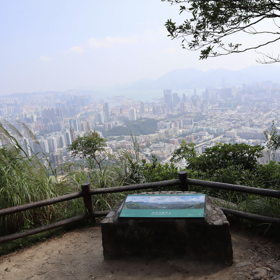
畢架山觀景台
Beacon Hill Viewing Point
Points: 75
Map Location: View Map
The Beacon Hill Viewing Point is located on the hillside of Beacon Hill, about 400 meters above sea level, and is part of the Lion Rock Country Park. From the Observation Deck, you can enjoy a panoramic view of the Kowloon Peninsula and the Hong Kong Island on the other side.
豐力樓
Phoenix House
Points: 100
Map Location: View Map
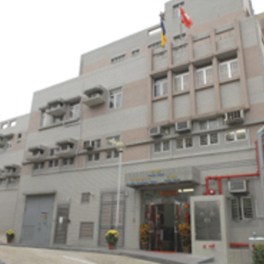
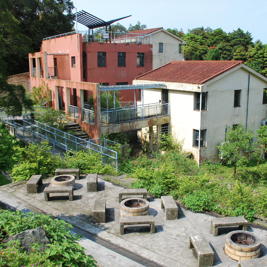
Poenix House is a halfway house opened by the Correctional Services Department. It is a male juvenile hostel, which refers to a hostel set up by the Hong Kong Correctional Services Department for some released prisoners to stay temporarily. The department has been providing rehabilitation and accommodation services for these prisoners to help them re-adapt to social life. Not only does it allow residents to go out during the day, but also encourages relatives and friends to go there in person to support them.
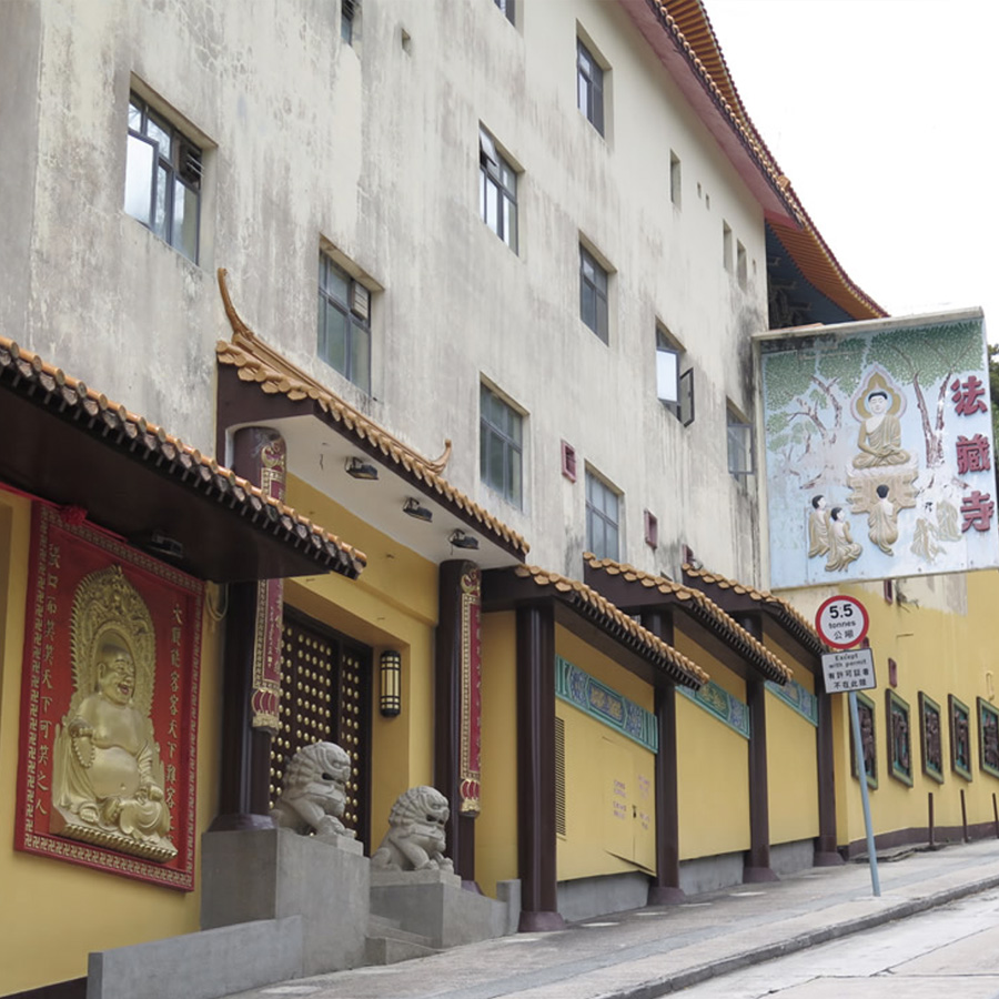
慈雲山法藏寺
Temple Hill Fat Jong Temple
Points: 125
Map Location: View Map
Fat Jong Temple is located on Shatin Pass Road in Tsz Wan Shan, near the eastern foot of Lion Mountain. It is a Buddhist temple. The temple was founded in 1948 and rebuilt in the 1980s. The temple has a three-entry structure. The Hengha Hall, Heavenly King Hall, Weituo Hall, Daxiong Hall, Guanyin Hall and Jialan Hall in the temple enshrine many Buddha statues with different appearances. Fat Jong Temple is located in the urban area and is very popular.
蝌蚪坪涼亭
Fo Dau Ping Pavilion
Points: 150
Map Location: View Map
Fo Dau Ping is the viewing platform with the most open views in Maozai Mountain. As it is close to residential areas, it is also a hot spot for morning exercises for nearby residents.
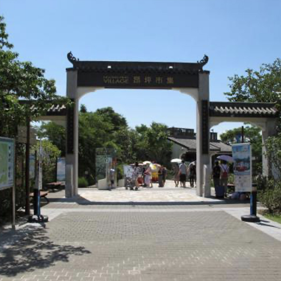
昂坪市集 (起點)
Ngong Ping Village (Starting point)
Points: 10
Remark: Start
Map Location: View Map
Ngong Ping Village is a tourist attraction located in Ngong Ping, Lantau Island, Hong Kong. Its architecture and garden design showcase the unique topography and cultural atmosphere of Ngong Ping. It also has many tourist attractions and 25 restaurants, shopping and entertainment facilities. There are also street art performances such as kung fu, juggling and Cantonese opera in the market.
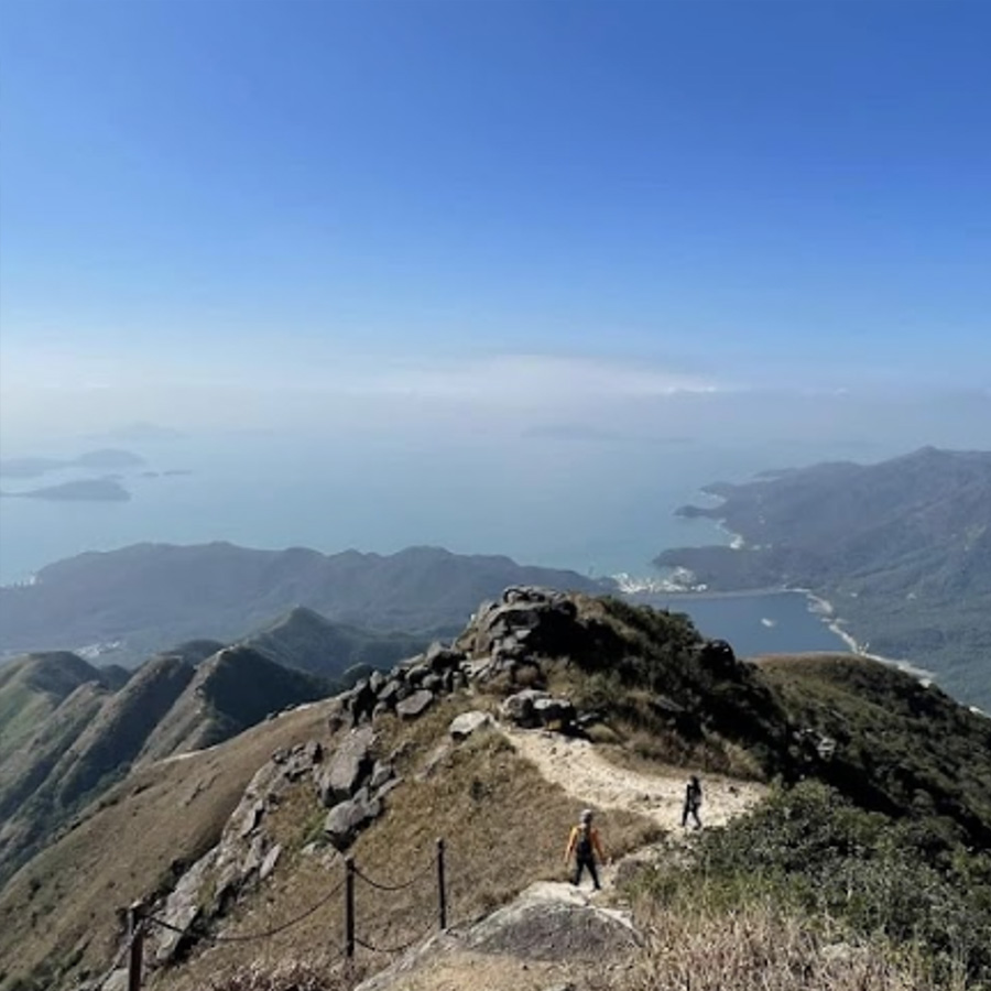
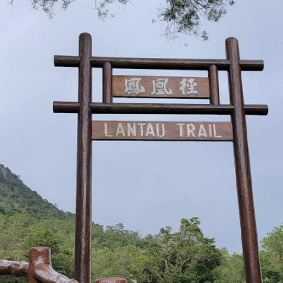
鳳凰山頂 (鳳峰)
Lantau Peak
Points: 200
Map Location: View Map
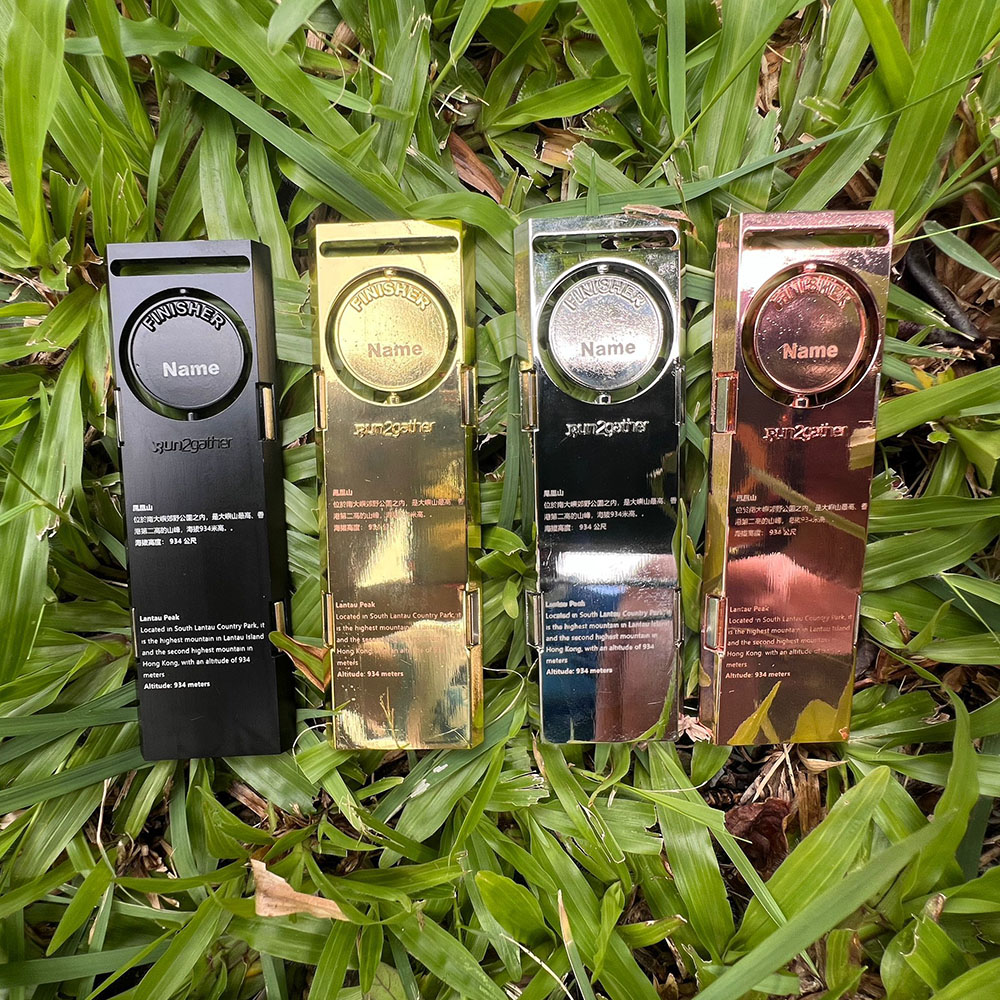
Lantau Peak has two peaks. The main peak (Fung Fung) is 934 meters above sea level, only 23 meters lower than Hong Kong's highest mountain, Tai Mo Shan (957 meters), and is the highest mountain on Lantau Island. The secondary peak (Wong Fung) is 918 meters above sea level. As the main peak and the secondary peak are very close, when looking at the twin peaks of Lantau Peak from a distance, one would have the illusion that the top of the mountain is "rotten", so it is also called "Rotten Head Mountain".
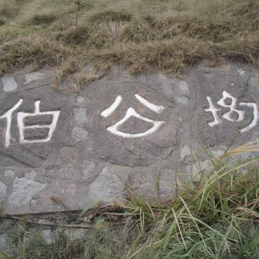
伯公坳
Pak Kung Au
Points: 150
Map Location: View Map
Pak Kung Au is the junction of the third and second sections of the Phoenix Trail, which lead to Lantau Peak in the west and Tai Tung Mountain in the east respectively, becoming a major stop for hikers heading to the two mountains. Pak Kung Au is also a stop on the South Lantau Country Trail.
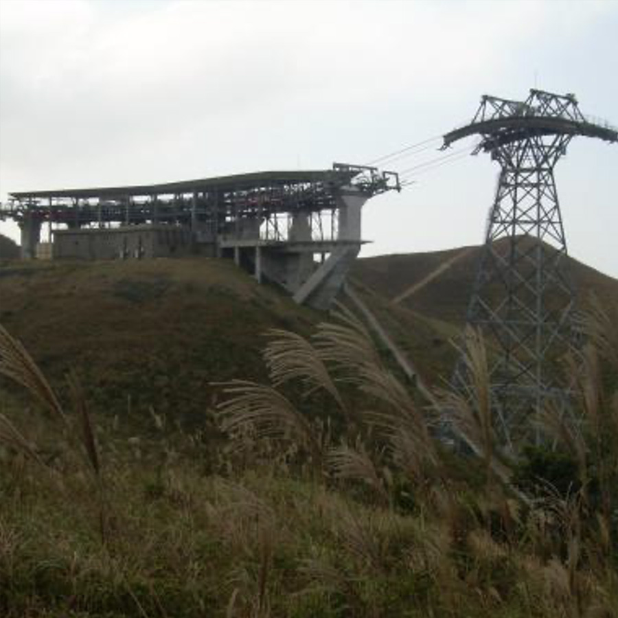
彌勒山轉向站
Nei Luk Shan Angle station
Points: 100
Map Location: View Map
Nei Luk Shan Angle Station is one of the turning stations of Ngong Ping 360. The station is located on the hillside of Nei Luk Shan, north of Ngong Ping in the Outlying Islands District. The turning angle is about 20 degrees. Ngong Ping 360 is 5.7 kilometers long and has two turning stations along the way. After the cable car leaves Ngong Ping, it passes through the No. 7 and No. 6 cable towers and enters the Nei Luk Shan Angle Station. The cable car will turn here and then descend, passing the Airport Island Angle Station to Tung Chung, and vice versa.
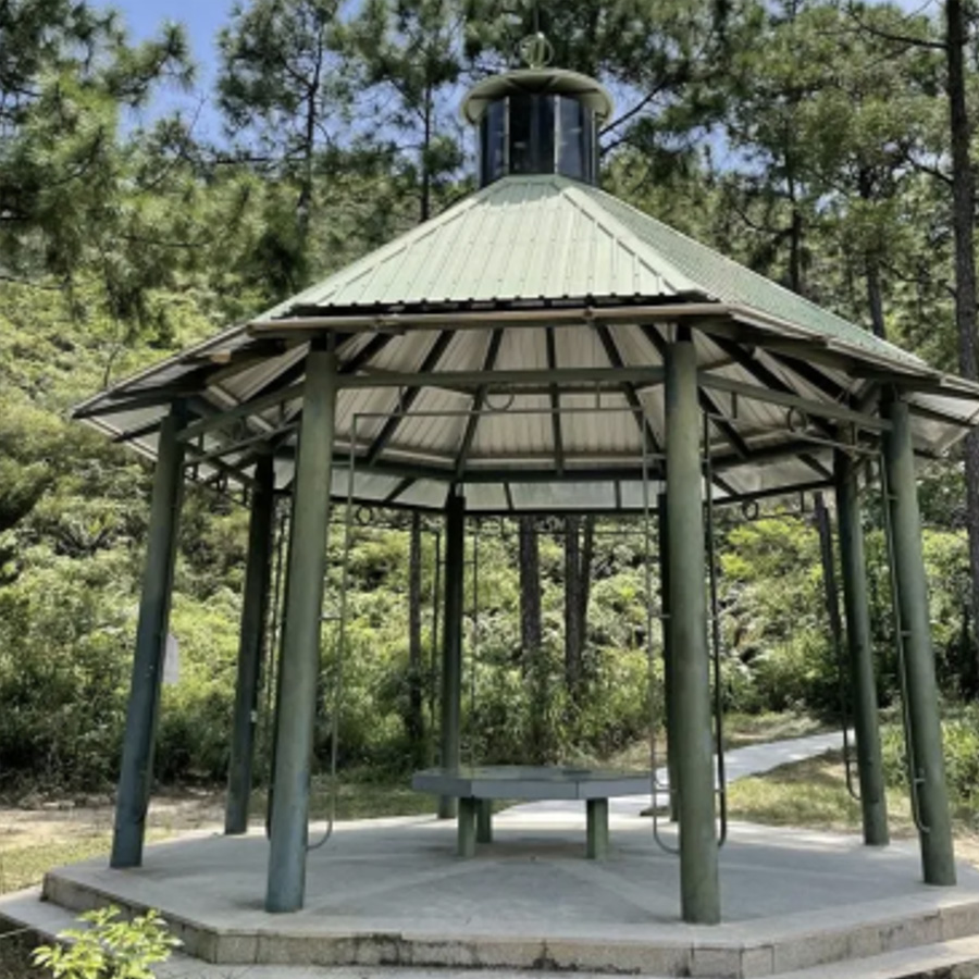
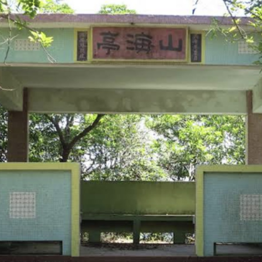
山海亭
Mountains and Seas Pavilion
Points: 75
Map Location: View Map
The inscription on this pavilion was also written by Master Fa Ke. It was an excellent viewing spot in the early years, but it has now been covered by the jungle, which is a pity.
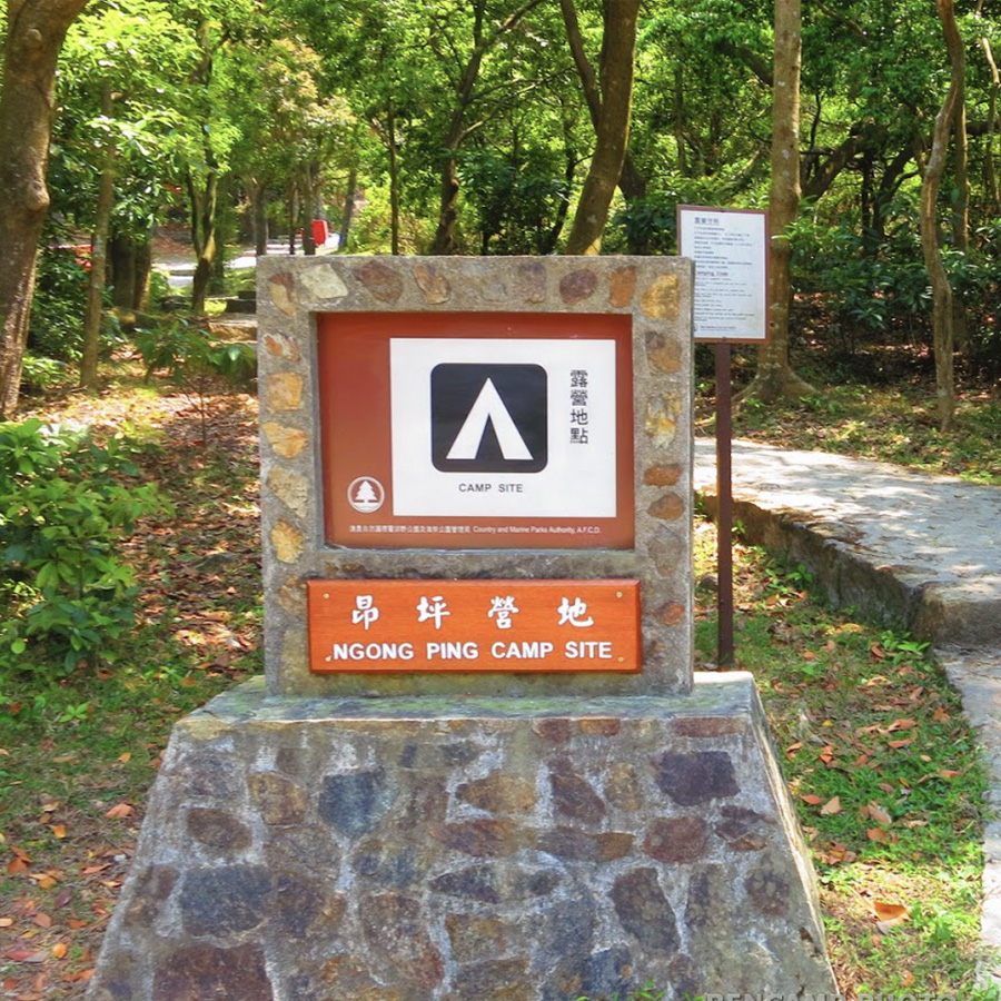
昂坪營地
Ngong Ping Campsite (Lantau)
Points: 50
Map Location: View Map
Ngong Ping Campsite is located between Lantau Peak and Nei Luk Shan, surrounded by valleys. The campsite covers a large area, has a quiet environment, complete facilities and convenient transportation.
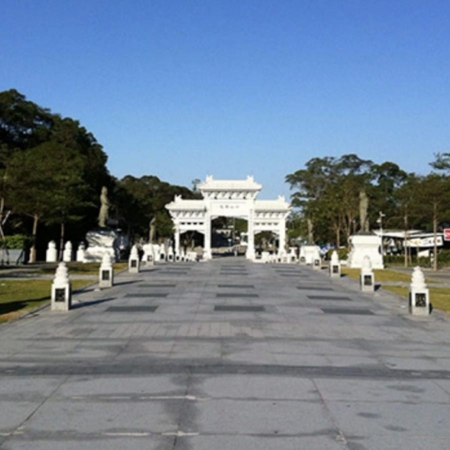
昂坪廣場
Ngong Ping Piazza
Points: 25
Map Location: View Map
Ngong Ping Piazza has four main components, namely new Pai Lau, Bodhi Path, Di Tan and a Chinese landscaped garden. It connects with Po Lin Monastery, the Big Buddha, Ngong Ping Cable Car, Ngong Ping Village and Wisdom Path. This is where visitors could get started and tour to observe the religions and nature of Ngong Ping.
鳳凰山三段二號觀景亭
Lautau Peak Section 3 No. 2 Observation Pavilion
Points: 50
Map Location: View Map
The Agriculture, Fisheries and Conservation Department has set up a sunrise and sunset timetable at the starting point of Pak Kung Au on the third section of the Phoenix Trail. A temporary mountain shelter has also been built on the top of the mountain to facilitate visitors to stay warm in the shelter when hiking in windy and cold weather, so as to avoid the strong wind chill effect on the body and cause hypothermia.
二東山
Yi Tung Shan
Points: 250
Map Location: View Map
Yi Tung Shan is a mountain with an altitude of 752 meters in Hong Kong. It is located in the eastern part of Lantau Island in the New Territories and on the west side of Tai Tung Mountain. The second section of the Phoenix Trail passes through the northern part of the mountain. Yi Tung Shan is the eighth highest mountain in Hong Kong.
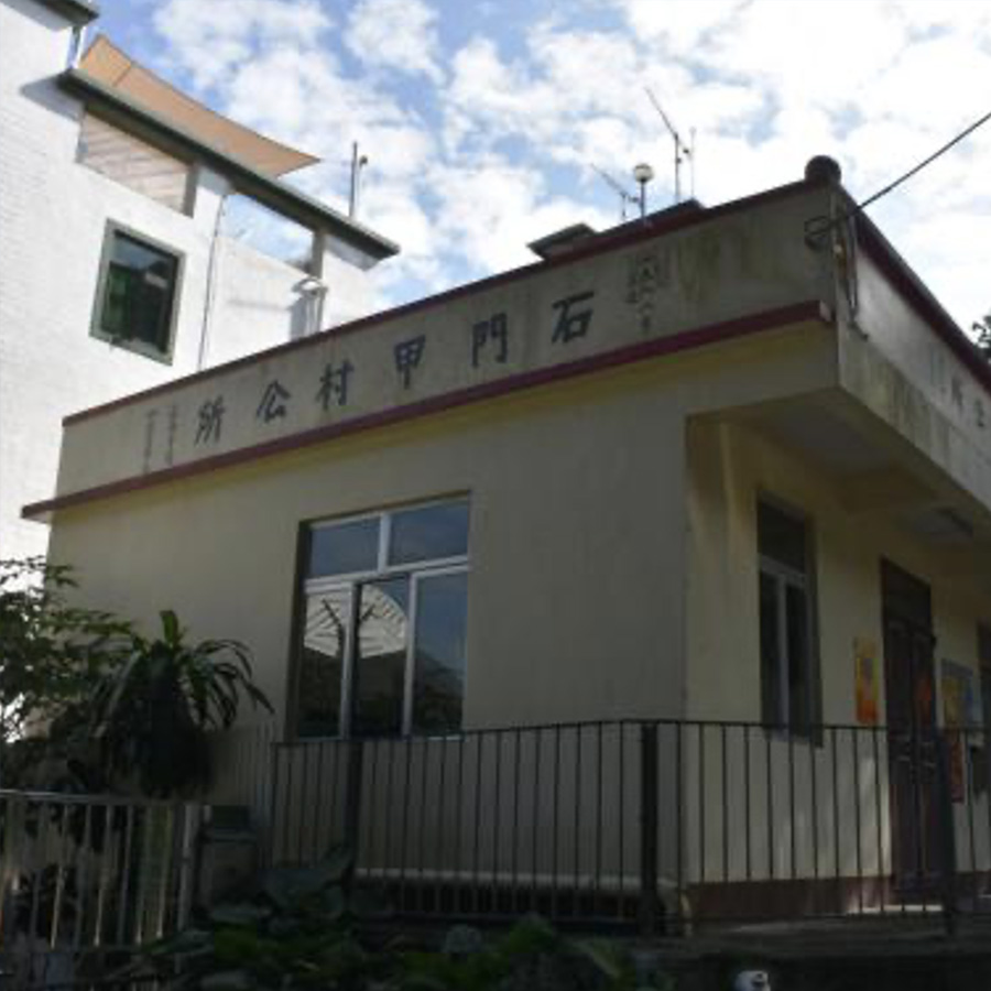
石門甲
Shek Mun Kap
Points: 150
Map Location: View Map
Shek Mun Kap is located in the southern part of Tung Chung, Lantau Island, Hong Kong. It is a suburban area in principle. It is a stop on the Famen Trail and a major hiking route and highway stop between Tung Chung and Ngong Ping Po Lin Monastery and The Big Buddha.
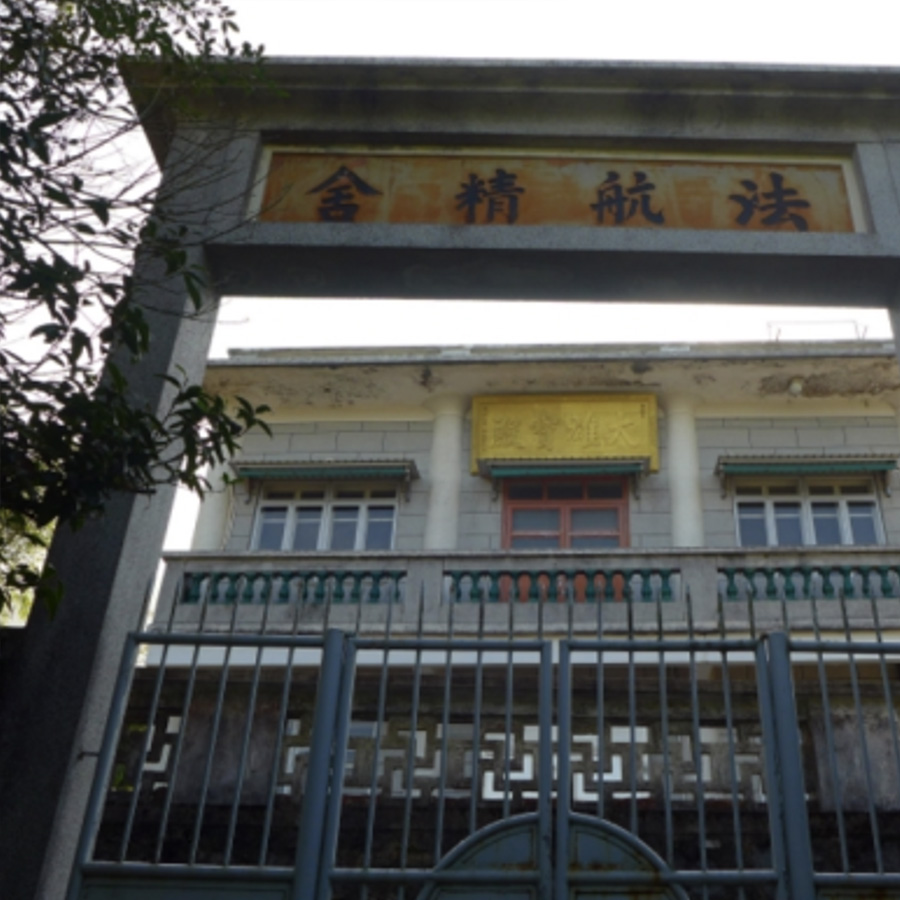
法航精舍
FaHong Monastery
Points: 75
Map Location: View Map
Fa Hong Monastery is located deep in the mountains of Lantau Island. It was the residence where Master Fa Hai practiced. Our practice is based on the "Four Mindfulness" taught by the Buddha. We will hold regular meditation camps at the center, and members can also make an appointment to practice alone.
羌山野餐區
Keung Shan picnic site
Points: 125
Map Location: View Map
Keung Shan Country Trail starts from the Kau Ling Chung Catch Water. The first section is quite difficult, climbing to the mountainside of Ling Wui Shan, about 300 meters high, and then you can walk easily on the gentle mountain trail. From here, looking southeast, you can see the beautiful sea view.
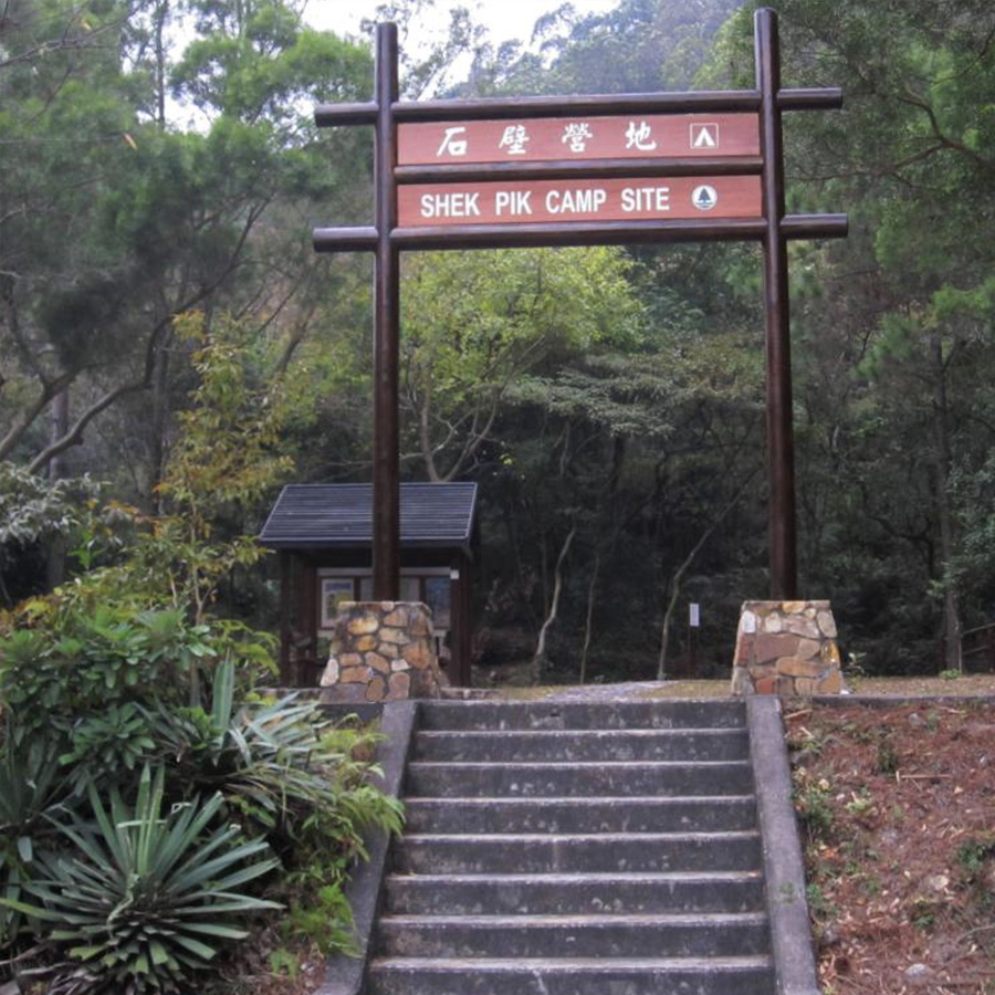
石壁營地
Shek Pik Campsite
Points: 150
Map Location: View Map
Shek Pik Campsite is one of the campsites in Hong Kong. It is dedicated to camping and is located in Shek Pik, next to Keung Shan Road. It belongs to South Lantau Country Park and is administratively under the Outlying Islands District. The campsite is small, with less than 20 campsites. The water source is taken from the toilet. It is under the jurisdiction of the Agriculture, Fisheries and Conservation Department.
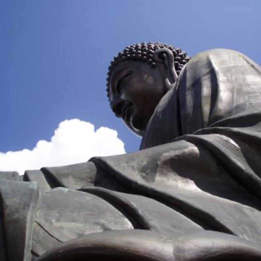
天壇大佛
Tian Tan Buddha
Points: 50
Map Location: View Map
The Tian Tan Buddha is a statue of Sakyamuni Buddha located on the Muyu Peak in front of the Po Lin Monastery on Lantau Island, Hong Kong. It is located in Ngong Ping, 520 meters above sea level. It is the world's tallest outdoor bronze Buddha and one of Hong Kong's famous tourist attractions. The Buddha statue sits on 268 stone steps and is composed of 207 copper pieces (165 pieces of Buddha body, 36 pieces of lotus, and 6 pieces of cloud head). It is 26.4 meters high. Including the lotus seat and the base, the total height is about 34 meters. It weighs 250 metric tons and sits on a 3-story altar. The Tian Tan Buddha was planned and built by the Po Lin Monastery since 1981 and was consecrated on December 29, 1993. It took 12 years and cost more than 60 million Hong Kong dollars.
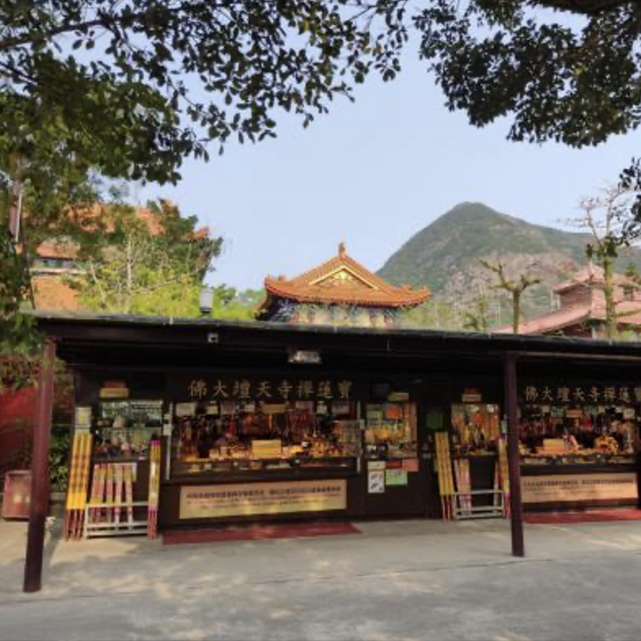
祈福廣場
Worship Plaza
Points: 40
Map Location: View Map
Po Lin Monastery is a Buddhist temple in Hong Kong and one of the tourist attractions in Hong Kong. It is located in Ngong Ping, Lantau Island, New Territories, between Nei Luk Shan Mountain and Lantau Peak. The temple was originally a thatched hut built in 1906 by three Zen masters, Dunxiu, Dayue and Yueming. It was not until 1924 that the first abbot, Monk Jixiu, officially named it Po Lin Monastery. The Workship Plaza is in front of Po Lin Monastery.
大帽山郊野公園茶水亭 (起點)
Tai Mo Shan Country Park Refreshment Kiosk (Starting point)
Points: 10
Remark: Start
Map Location: View Map
The Agriculture, Fisheries and Conservation Department obtained the operating rights of the Tai Mo Shan Tea House through a tender. For many years, it has been run by Jiang Huo Lian "Sister Lian", who insists on getting up at 5:00 a.m. every day to catch the bus and arrive at the tea house on time at 7:00 a.m. to prepare for the new day. "Running the tea house has allowed me to meet many different people. Their deep love and kindness have enabled me to move forward. I am grateful for everything I have now."
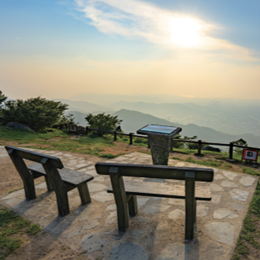
大帽山觀景台
Tai Mo Shan Lookout
Points: 40
Map Location: View Map
Leaving the visitor center and continuing up, you will enter the eighth section of the MacLehose Trail. Going up the hillside, you will reach the Tai Mo ShanLookout, which is quite open and windy, and you can enjoy a magnificent panoramic view of Hong Kong.
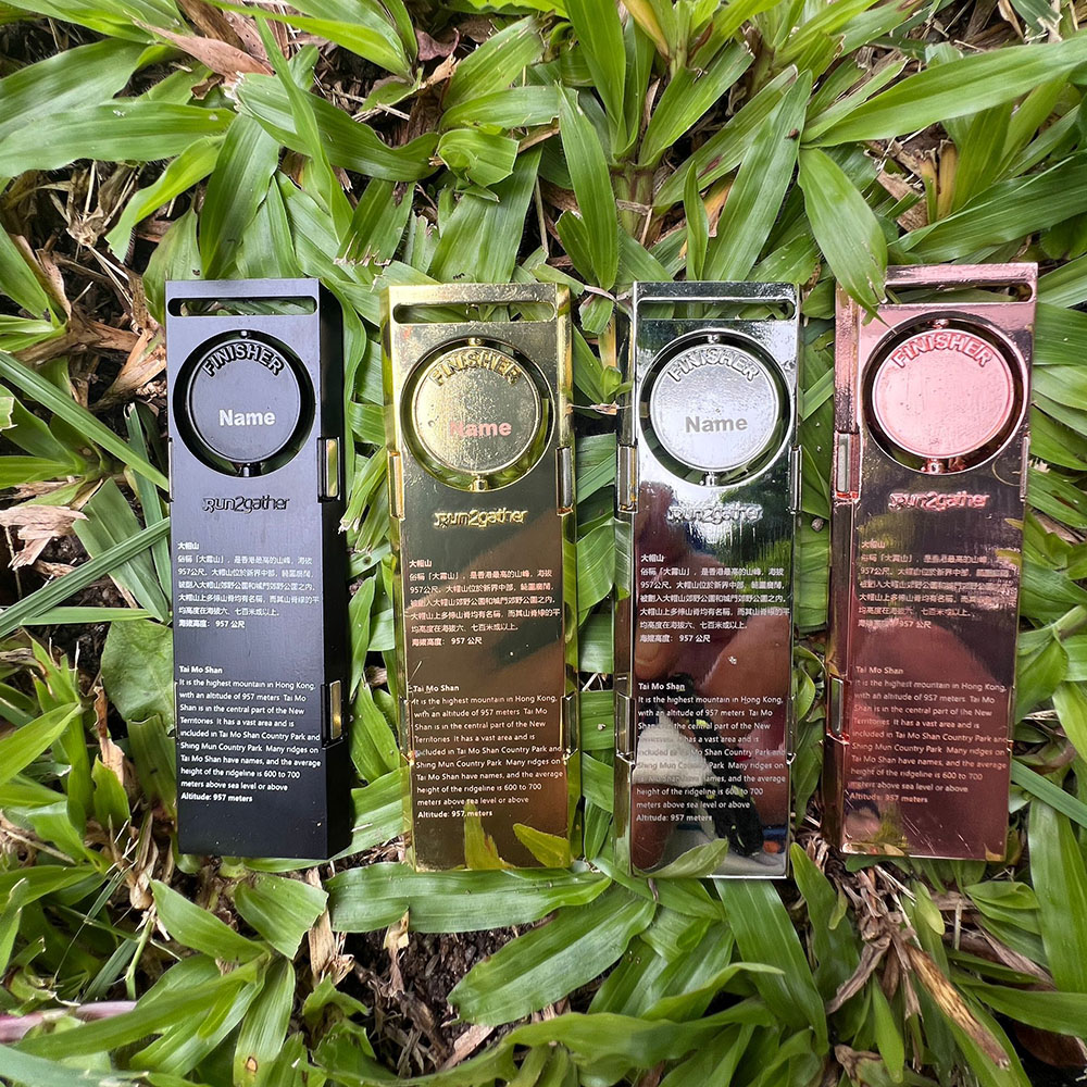
大帽山頂
Tai Mo Shan Peak
Points: 250
Map Location: View Map
When you see the Hong Kong Observatory Weather Radar Station, which looks like a giant golf ball, you are not far from the 957-meter-high mountain top. Don't miss this great spot to check in, because from the height of no one, you can enjoy the scenery of the continuous ridges, towns, rivers and seas. On a clear day, you can almost see the entire mountains, urban areas, islands and ports of Hong Kong.
四方亭
Sifang Pavilion
Points: 100
Map Location: View Map
A rest area before the steepest section of the road on Tai Mo Shan.
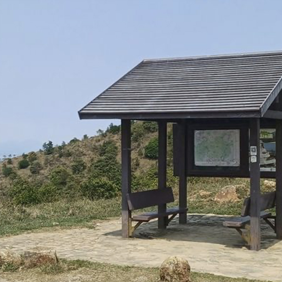
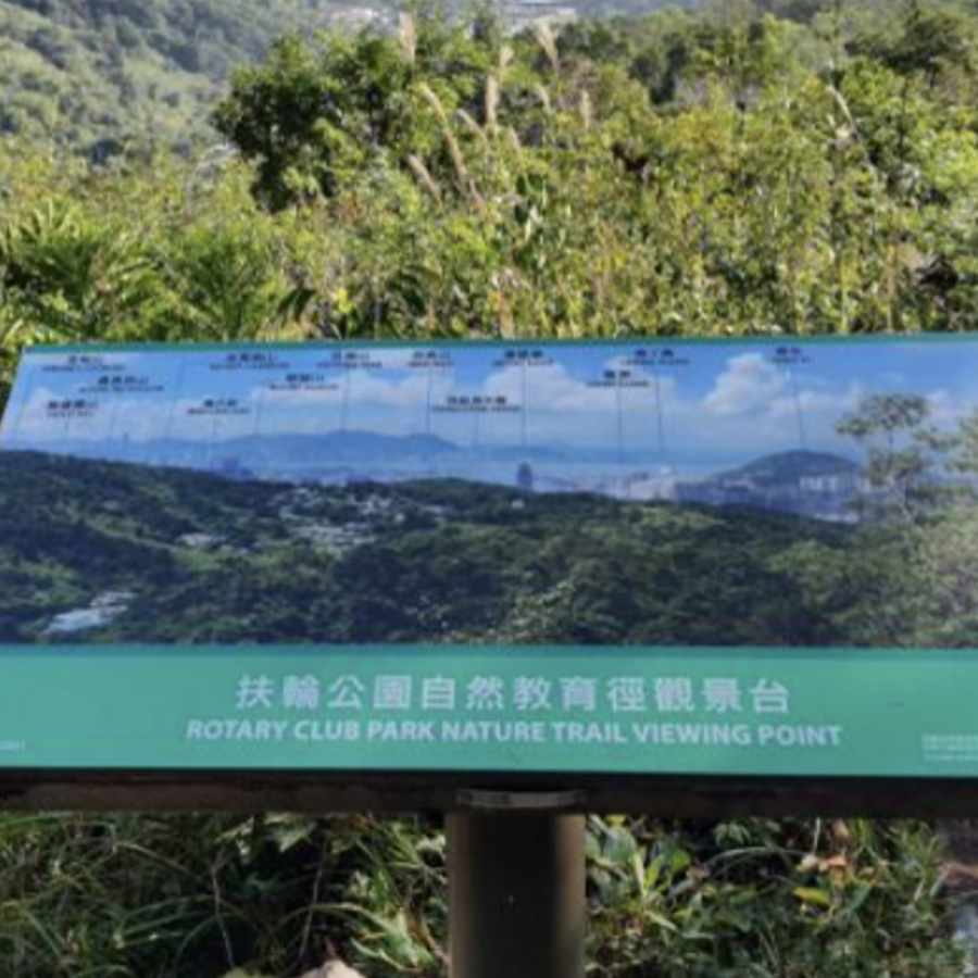
扶輪徑觀景台
Rotary Club Park Nature Trail Viewing Point
Points: 75
Map Location: View Map
Climbing up the stairs from the parking lot, you will first see a sundial in the center of the garden. In spring, you can enjoy the Taiwan Prunus campanulata blossoms in full bloom. Walk to the Rotary Park Nature Trail Viewing Point, where you can see Victoria Harbour and the Hong Kong Island across the river through the gaps between the grass and trees. If you continue to explore along the trail, you will reach a Chinese pavilion hidden in the shade of the trees in a few minutes.
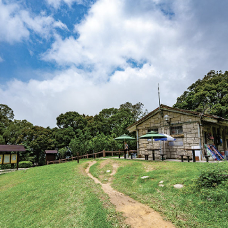
施樂園
Sze Lok Yuen
Points: 75
Map Location: View Map
This is the highest YHA Sze Lok Yuen Tai Mo Shan Youth Hostel in Hong Kong, which brings you a different experience. You can climb the 957-meter main peak along Tai Mo Shan Road in the early morning to watch the sunrise and sunset, and have the opportunity to see the sea of clouds and frost. After watching the sunrise, you can walk to Chuen Lung Village to taste the local traditional Cantonese delicacies and mountain tea. In the evening, you can have a barbecue at the hostel, chat with a few close friends, or lie on the grass to watch the charming starry sky at night.
燕岩頂
Yin Ngan Peak
Points: 50
Map Location: View Map
Yin Ngan Peak is located south of Tai Po and Yan Yan. It is geographically located in Tai Po District and close to the border of Tsuen Wan District. The Tai Mo Shan mountain range extends eastwards, and Yan Yanding is located on the ridge, with an altitude of 679 meters. The MacLehose Trail passes near the peak.
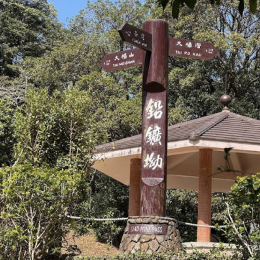
鉛礦坳
Lead Mine Pass
Points: 150
Map Location: View Map
Lead Mine Pass is located at the entrance of Section 8 of the MacLehose Trail and Section 7 of the Wilson Trail. It is well connected and is the only way to Tai Mo Shan and Tai Po. It takes half an hour to walk to the top of Grass Hill, where you can overlook the scenery of the North District. There is a natural jungle nearby, which breeds many wild animals and birds, and the birds are singing and the flowers are fragrant, which is unique.
大欖林道涼亭
Tai Lam Forest Track Pavilion
Points: 150
Map Location: View Map
Tai Lam Forest Trace Pavilion is one of the Mountain Bike Practice Loop/Practice Ground.
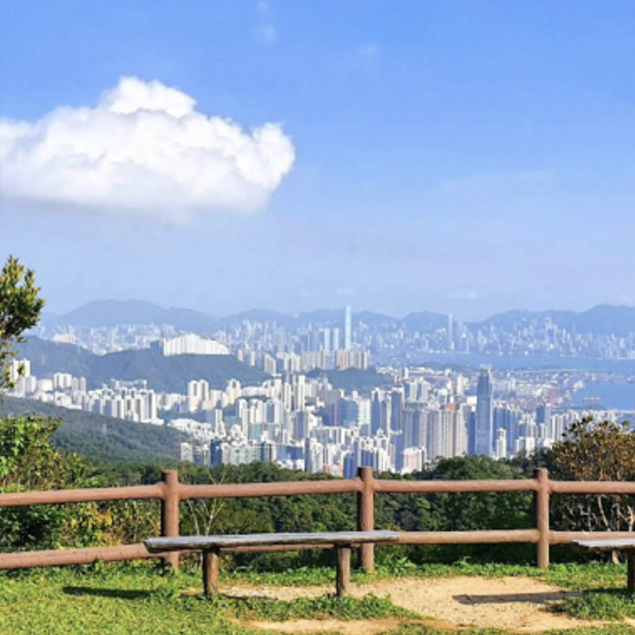
荃灣市區瞭望處
Tsuen Wan Urban Lookout
Points: 50
Map Location: View Map
This is one of the viewing points of Section 9 of the MacLehose Trail. From here, you can see Tsuen Wan city in the distance, and Chuen Lung and Tai Mo Shan Peak on the left. The surrounding scenery is very beautiful, with cool breezes and plenty of shade from the trees. It is a rare good place to go in summer.
川龍村
Chuen Lung Village
Points: 125
Map Location: View Map
Located on the hillside of Tai Mo Shan on Route Tsuen Kam in Tsuen Wan. This is a village of the single surname Tsang, whose ancestral home is in Shandong. They migrated to the south in the late Southern Song Dynasty and moved here during the Yongle period of the Ming Dynasty. Chuen Lung Village has a watercress field and is famous for producing local watercress.
胡挺生先生紀念亭
T.S. Woo Memorial Pavilion
Points: 125
Map Location: View Map
Mr. T.S. Woo was the first manager who helped create the park's current appearance. The memorial pavilion stands on the ridge, surrounded by pine trees and bell-flowered cherries. January to February is the best time to enjoy the cherry blossoms.
梧桐石澗徑
Ng Tung Waterfall Path
Points: 75
Map Location: View Map
Sifang Col is the col between Tai Mo Shan and Sifang Shan. There is a large pavilion on the top of the col. It is also the end of Tai Mo Shan Forest Trail and the only way to get there from the east and north. "Ng Tung Waterfall Path" is the trail between "Ng Tung Chai" and "Sifang Col" and is also the starting point of this route.
大帽山山火瞭望站
Tai Mo Shan fire lookout station
Points: 75
Map Location: View Map
September to April of the following year is the peak season for wildfires. In order to detect wildfires, the Agriculture, Fisheries and Conservation Department has set up wildfire lookouts in many places in Hong Kong.
八鄉山火瞭望台
Pat Heung Fire Lookout
Points: 150
Map Location: View Map
Crocodile Peak is located to the west of Tai Mo Shan, 559 meters high, and its official name is Pat Heung Fire Lookout. It is said that the name "Crocodile Peak" comes from the fact that when you look down at Ho Pui Reservoir from the top of the mountain, it looks like a crocodile looking up at the sky. Tin Fu Tsai Hill is located to the west of Crocodile Peak, 461 meters high, and has Tin Fu Tsai Fire Lookout, which offers a panoramic view of the Tsing Ma Bridge and Tai Lam Chung Reservoir.
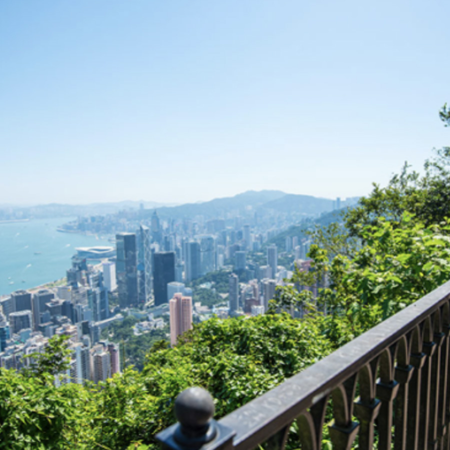
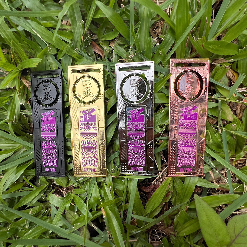
The Peak Tower (Starting point)
Points: 10
Remark: Start
Map Location: View Map
The Peak Tower, Hong Kong's No. 1 destination, also one of the most stylish architectural icons in Hong Kong. With an avant-garde design representing the epitome of modern architecture, the spectacular tower has been featured in millions of photographs and postcards across the world.
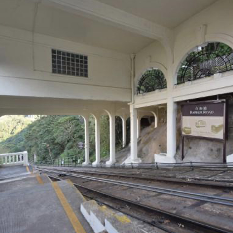
Peak Tram Barker Road Station
Points: 40
Map Location: View Map
Barker Road is an intermediate station on the Peak Tram funicular railway line, and is located on Barker Road in the Peak, Central and Western District, Hong Kong, 363 metres (1,191 ft) above sea level. The station opened in 1888 along with the tramline. At this time it was named Plantation Road station as Barker Road was built not before 1898. Today, Barker Road itself passes under the tramway at the uphill end of the station on a bridge.
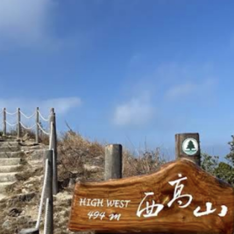
Mt. High West Viewing Point
Points: 125
Map Location: View Map
At 493m above sea level, High West towers between Victoria Harbour and Mount Davis with a magnificent view of Hong Kong from Pok Fu Lam Reservoir right over to Victoria Harbour. It is one of the most famous sunset spots on The Peak.
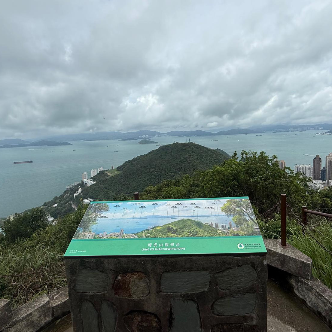
Lung Fu Shan Viewing Deck
Points: 75
Map Location: View Map
In proximity to the Mid-levels and the Western District, Lung Fu Shan is intensively used by members of the public, especially by morning walkers and picnickers. It is situated to the north of Pok Fu Lam Country Park. Towards the east of Lung Fu Shan Country Park is Hatton Road, to the south is Harlech Road whereas to the north and west is a covered conduit constructed by the Waterworks Office. This country park covers an area of about 47 hectares (120 acres), making it the smallest country park in Hong Kong.
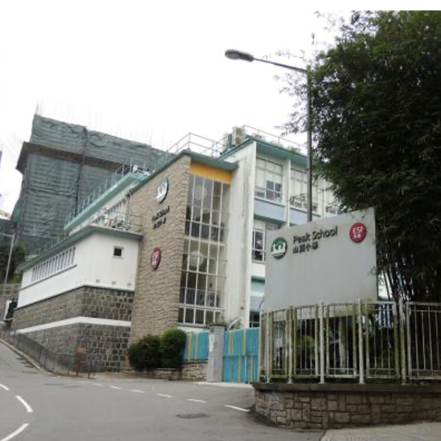
Peak School
Points: 50
Map Location: View Map
Peak School is a coeducational preparatory school, located on Plunkett's Road on Victoria Peak, Hong Kong Island, Hong Kong. The school is one of around twenty institutions in Hong Kong operated by the English Schools Foundation (ESF). The school opened in 1911.[citation needed] Its first school building was built by the Public Works Department in 1915 at No.7 Gough Hill Path. The building now houses the Victoria Peak Fire Station.
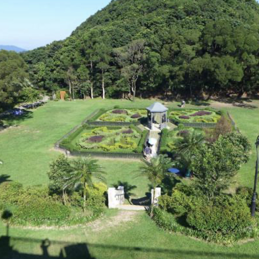
Victoria Peak Garden
Points: 100
Map Location: View Map
The Hong Kong government announced on 25 September 2005 that the site will be redeveloped along with the rest of the Peak area. The ample open space, vast amount of grassy lawn and stream course at the site will be preserved. To bring out the heritage elements, the garden will be enhanced with Victorian style features including gazebos, benches, sun-dials and colourful flowers. Artifacts from the Victorian era, such as stone pillars and carvings, will be displayed to enrich the visitors' experience.
Hill Above Belcher's Peak
Points: 150
Map Location: View Map
Pinewood Battery is a disused military site constructed around 1903, which has been preserved within the country park. The park has interpretive signage illustrating the historical significance of the battery.
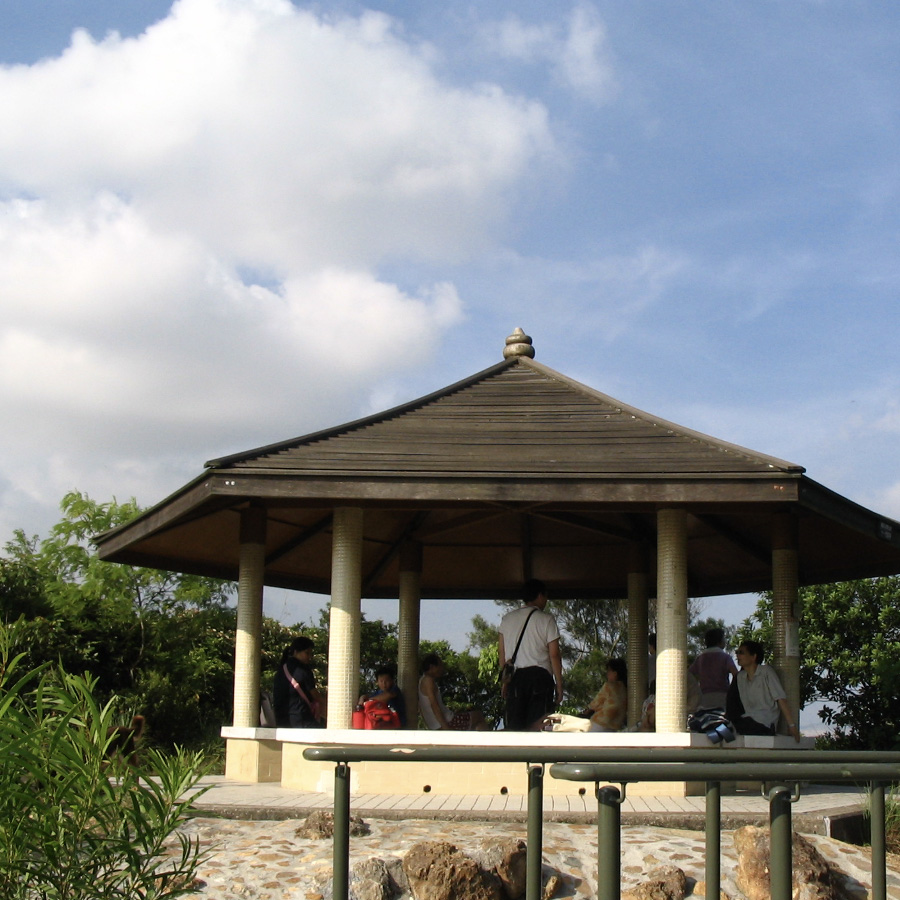
Lugard Road Lookout
Points: 75
Map Location: View Map
Lugard Road Lookout offers a spectacular panoramic view of Victoria Harbour.
Junction Of Hong Kong Trail Sec.1 & Sec.2
Points: 100
Map Location: View Map
The Hong Kong Trail, opened in 1985, is a long-distance footpath from Victoria Peak to Big Wave Bay on Hong Kong Island. It is a 50-kilometre (31 mi) walking route which passes through the five country parks on Hong Kong island. Section 1 from The Peak to Pok Fu Lam Reservoir.
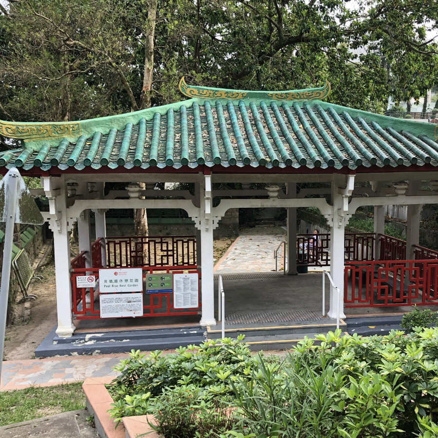
Peel Rise Rest Garden
Points: 100
Map Location: View Map
From the Peak Fire Station, turn into Peel Rise Road from Gough Hill. Not far away, there are many luxury residential properties for celebrities. Going further along the road, you will see a Chinese-style pavilion, which is the Peel Rise Rest Garden. You can stop here for a rest.
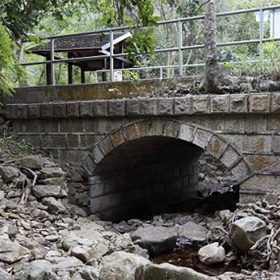
Pok Fu Lam Reservoir Stone Bridge
Points: 125
Map Location: View Map
Pok Fu Lam Reservoir, formerly known as the Pokefulum Reservoir, is the first reservoir in Hong Kong. It is located in a valley in Pok Fu Lam, Hong Kong Island. It is near The Peak.It is actually two reservoirs with capacity of 260,000 m³. The stone bridge is located in the eastern part of the reservoir. It is built of granite and decorated with semicircular arches or flat round arches, reflecting the influence of Italian Renaissance style. Four of them were declared monuments as early as 2009, and the last one was approved in mid-2020.
Junction Of Hong Kong Trail Sec.12 & Sec.3
Points: 150
Map Location: View Map
The section 2 of the Hong Kong Trail runs from Pok Fu Lam Reservoir Road to Peel Rise Road, passing the fitness facilities and barbecue area in Pok Fu Lam Country Park, and then goes down the hillside of Mount Kellett to Peel Rise Road.
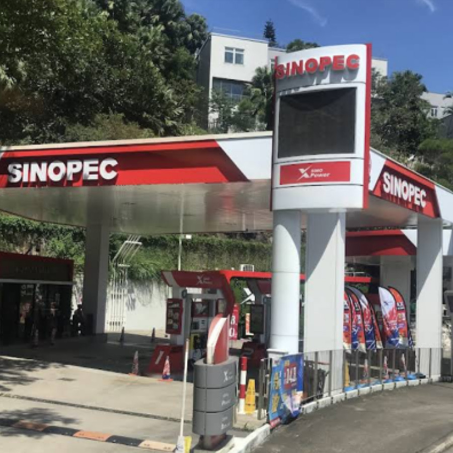
SINOPEC Peak Road
Points: 50
Map Location: View Map
At the SINOPEC gas station on The Peak Road, many celebrities drive their Lamborghinis, Larries, and even limited edition supercars to refuel every day.
Wan Chai Gap Park
Points: 150
Map Location: View Map
Wan Chai Gap Park is located at the end of Wan Chai Gap Road. The park is conveniently located and is the intersection of many hiking routes. It is also accessible by public transportation. Hikers often use Wan Chai Gap Park as the starting point or end point! Wan Chai Gap Park is not very large, but it has pavilions, wooden benches, snack kiosks and toilets. It is a good place for hikers to replenish supplies and rest during the hike!
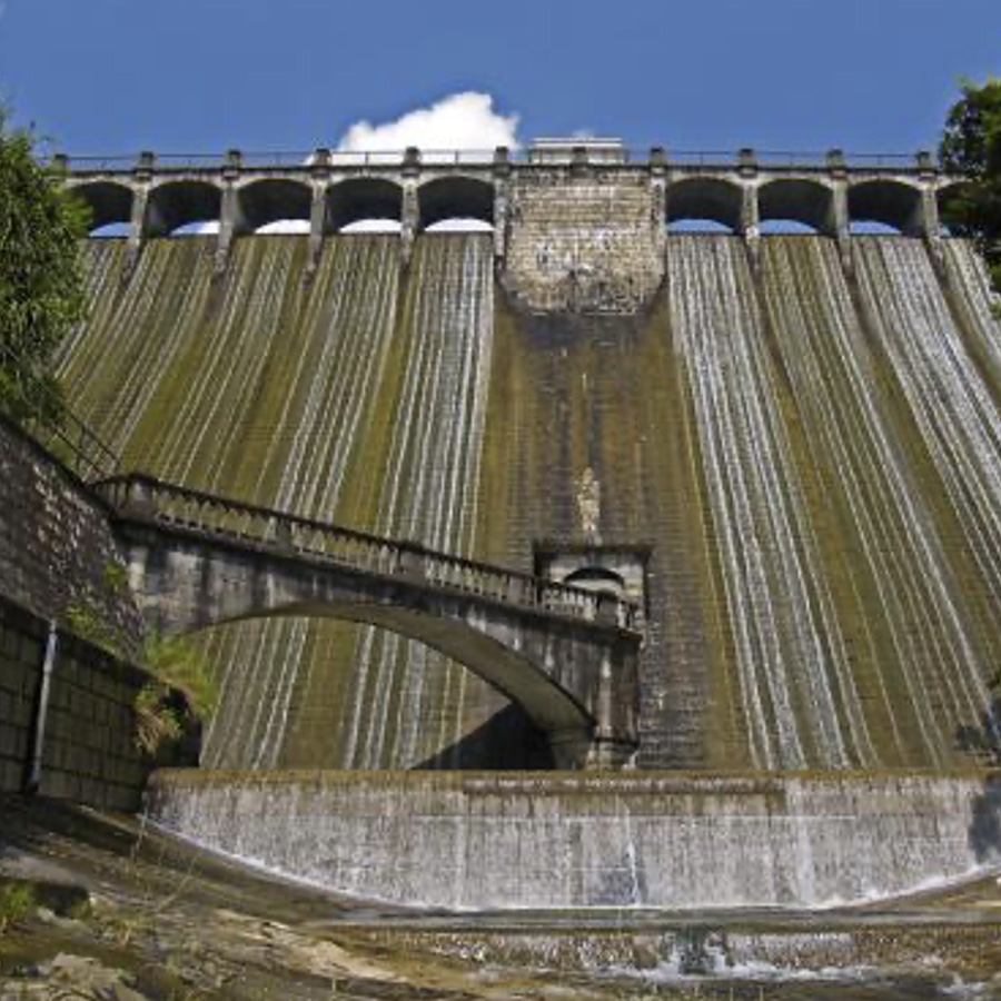
Upper Aberdeen Reservoir Main Dam
Points: 200
Map Location: View Map
Aberdeen Reservoir is a water catchment area in the Aberdeen Valley in Aberdeen Country Park in the southern part of Hong Kong Island, Hong Kong. Aberdeen Reservoir consists of the Aberdeen Upper Reservoir and the Aberdeen Lower Reservoir. The Aberdeen Upper Reservoir Dam was designed by Mr. R.M.Henderson of the Water Authority, built of granite in 1931 and declared a statutory monument on September 18, 2009.
鹿頸停車場 (起點)
Luk Keng Car Parking (Starting point)
Points: 10
Remark: Start
Map Location: View Map
Luk Keng Carpark is located on Bride's Pool Road. There are public minibuses going to and from Fanling Station. There are also convenience stores and cafes nearby for restocking.
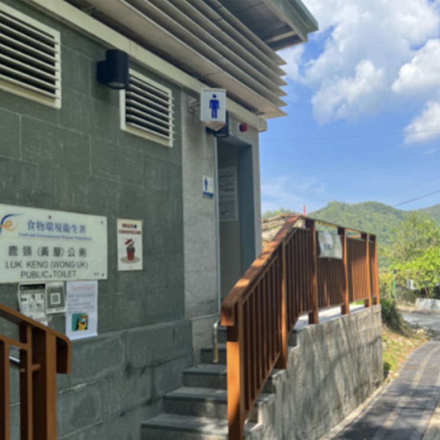
鹿頸(黃屋)公廁
Luk Keng (Wong Uk) Public Toilet
Points: 40
Map Location: View Map
Luk Keng Wong Uk is a recognized village under the New Territories Small House Policy. It is one of the villages represented within the Sha Tau Kok District Rural Committee. For electoral purposes, Luk Keng Wong Uk is part of the Sha Ta constituency.
南涌亭
Nam Chung Pavilion
Points: 50
Map Location: View Map
On the afternoon of March 3, 1943, the Japanese army dispatched nearly 100 people to surround the station of the Hong Kong and Kowloon Brigade Political Training Office at Yantai Mountain, Lao Longtian near Nanchong. At that time, there were only 11 unarmed personnel stationed there. They fought fiercely with the Japanese army and many soldiers died. This is known as the "March 3 Incident". Since Lao Longtian, where the March 3 Incident occurred, is located on a mountain and is difficult for ordinary people to visit, it is now planned to set up a monument to the March 3 Incident at Nanchong Pavilion at the foot of the mountain as a visiting point for the Cultural Heritage Trail.
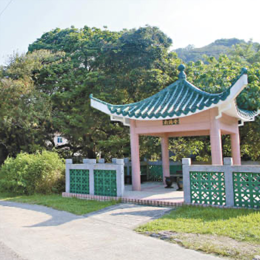
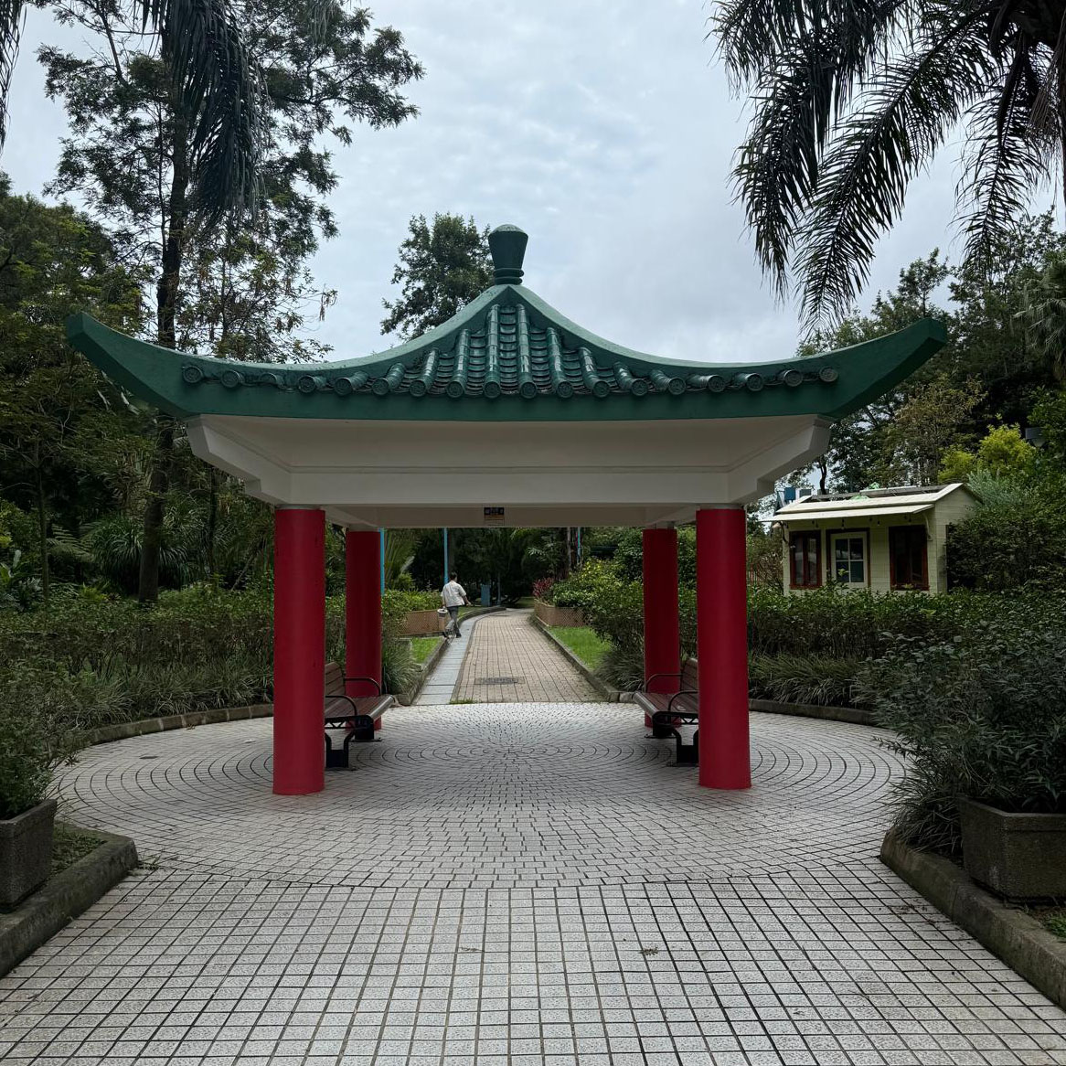
尤德爵士紀念亭
Sir Edward Youde Memorial Pavilion
Points: 75
Map Location: View Map
Sir Edward Youde (June 19, 1924 - December 5, 1986) was a senior British diplomat who was familiar with Chinese affairs and served as British Ambassador to China. During the Second Chinese Civil War, Edward Youde made contributions in the "Amethyst Incident" and was later awarded the British knighthood in 1949. In 1982, Edward Youde was appointed to succeed Sir Murray MacLehose as the 26th Governor of Hong Kong. During his tenure, he witnessed the signing of the Sino-British Joint Declaration between China and Britain in 1984, confirming that China would exercise sovereignty over Hong Kong from July 1, 1997. Edward Youde died of a heart attack during his visit to Beijing on December 5, 1986, becoming the only Governor of Hong Kong to die in office. This pavilion is composed of two traditional Chinese pavilions connected by hexagonal spires. This pavilion was built to commemorate his frequent outings here.
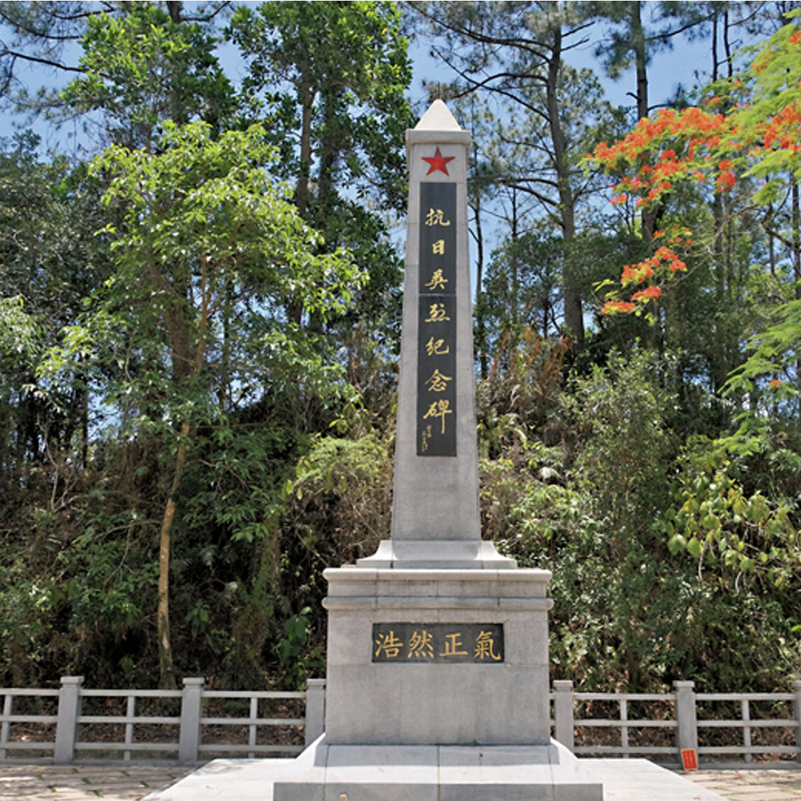
烏蛟騰抗日英烈紀念碑
Wu Kau Tang Martyrs Memorial Garden
Points: 75
Map Location: View Map
Cenotaph for Martyrs, Wu Kau Tang The Cenotaph, located in the Wu Kau Tang Martyrs Memorial Garden, is a memorial to honour the East River People’s Anti-Japanese Guerillas members and the Wu Kau Tang villagers who sacrificed themselves to defend Hong Kong against the Japanese invaders during Japan’s occupation of Hong Kong from 1941 to 1945. It is a local customs for the Wu Kau Tang rural community to pay their respects to the martyrs on the 16th day of the eighth lunar month, the day on which the then village representative was tortured to death by the Japanese invaders in 1942."
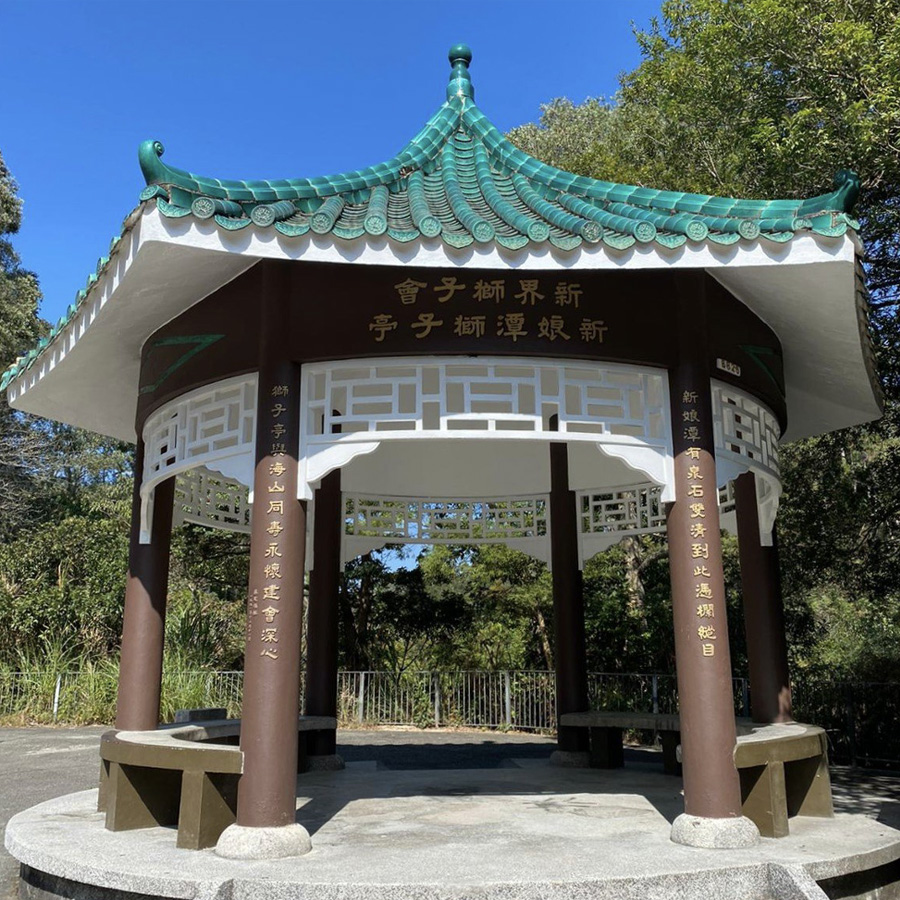
新娘潭獅子亭
Bride's Pool Lion's Pavilion
Points: 75
Map Location: View Map
Bride's Pool Lions Pavilion in Tai Po was also built in 1981 by Lions Club of The New Territories, Hong Kong. Bride's Pool is a popular picnic spot with a wide and spacious open area. During inclement weather, the tourists have to bear the uncomfortable sun scorching and rain soaking. In view of this, the Club proposed to build a Pavilion there for the benefit of the tourists. With the approval and assistance of Tai Po District Office, the present site was selected. It is also the starting point of Bride Pool's Nature Education Trail and the finishing point of the Pat Sin Leng Country Park's Nature Education Trail.
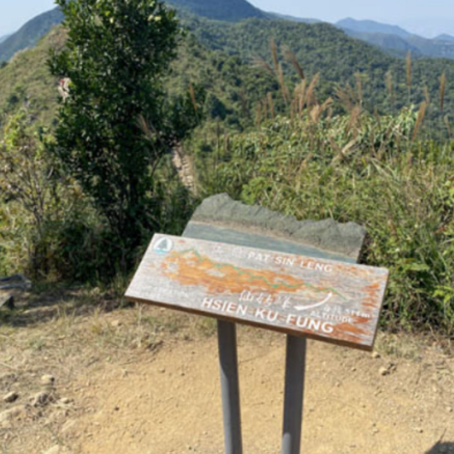
仙姑峰
Hsien Ku Fung
Points: 100
Map Location: View Map
Pat Sin Leng is a mountain range in the northeast New Territories of Hong Kong, located within the Pat Sin Leng Country Park. The name Pat Sin Leng literally means "Ridge of the Eight Immortals", who are eight well-known xian ("Immortals; Transcendents; Fairies") in Chinese mythology. The eight peaks along the Pat Sin Leng mountain range are each named after a different Immortal. Hsien Ku Fung is a mountain peak, part of the Pat Sin Leng range with an elevation of 511m. This is the easternmost peak of the range. The peak is named after one of the Eight Immortals, Immortal Woman He.
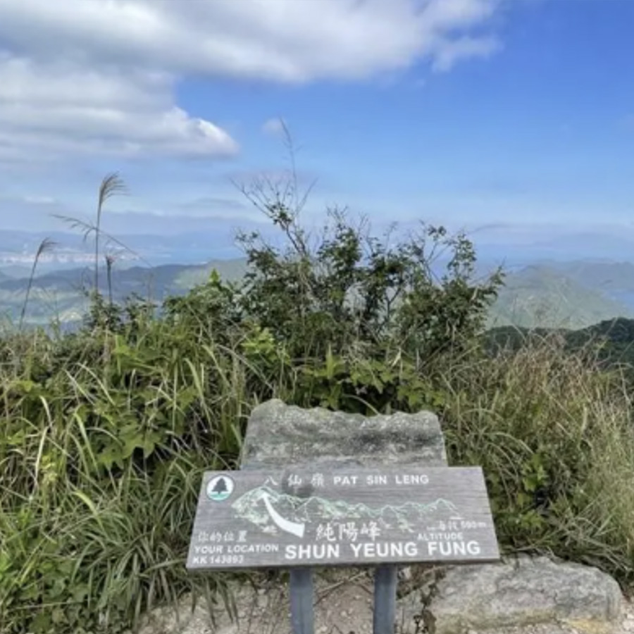
純陽峰
Shun Yeung Fung
Points: 250
Map Location: View Map
Shun Yeung Fung (純陽峰) is the sixteenth highest peak in Hong Kong with an elevation of 590m, located in north Tai Po of New Territories. It is also the westernmost and highest peak of the Pat Sing Leng mountain range. The peak is named after the leader of Eight Immortals, Lü Dongbin (呂洞賓)'s secular name Chunyang Zi (純陽子).
黃嶺
Wong Leng
Points: 100
Map Location: View Map
Wong Leng (literally: "Yellow Ridge") is on section 9 of the Wilson Trail in Pat Sin Leng Country Park, Hong Kong. It is 639 metres tall.
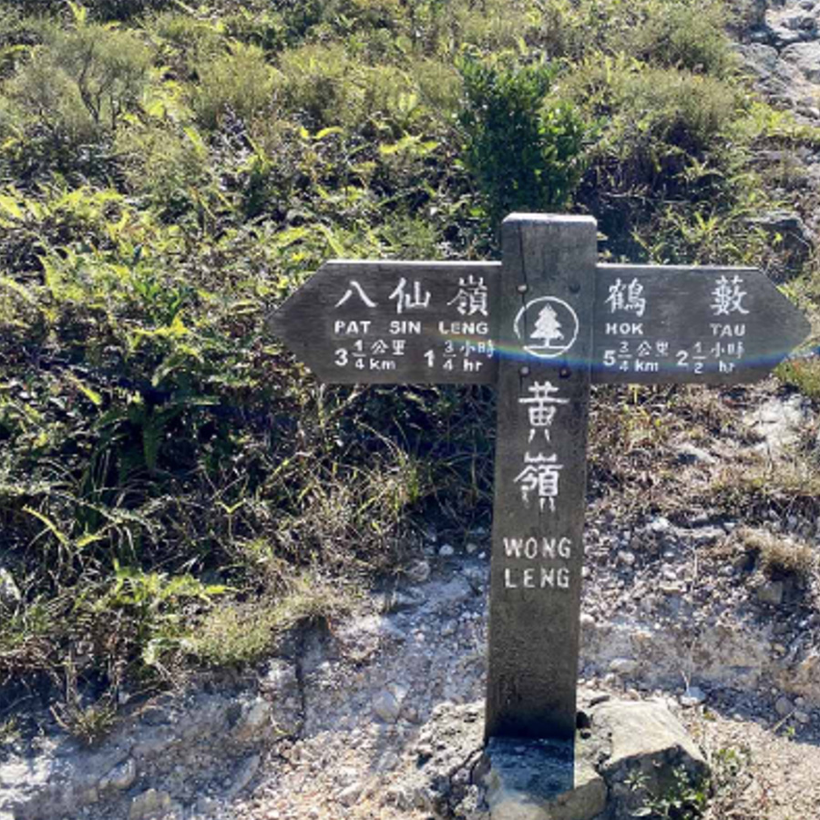
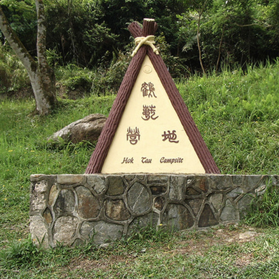
鶴藪營地
Hok Tau Camping site
Points: 50
Map Location: View Map
Situated at the northern slope of Shek Au Shan, the site is adjacent to the Hok Tau Reservoir. Apart from its picturesque environment, you are surrounded by luxuriant trees, songs of birds, fresh water stream which keep you cool in hot summer. The site features numerous routes connected with Sha Lo Tung or Lau Shui Heung Resevoir. You may also challenge nearby ranges such as Ping Fung Shan and Pat Sin Leng.
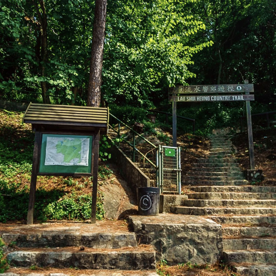
流水響郊遊徑﹣入口
Lau Shui Heung Country Trail - Entrance
Points: 150
Map Location: View Map
Lau Shui Heung Reservoir is a reservoir located within the boundary of Pat Sin Leng Country Park in the eastern part of North District, New Territories, Hong Kong. The entire reservoir is surrounded by tree-lined valleys and surrounded by mature woodlands, with rows of Melaleuca trees growing by the reservoir having full of greenery, very poetic and picturesque. The reservoir is quite deep, so the color of the reservoir is green, known as mirror of the sky in Hong Kong; the bottom of the reservoir is covered with sand and rocks of various sizes, providing a diverse habitat for different fishes. Many fish species can be found in the reservoirs, including Channa asiatica, which is uncommon in Hong Kong. Because of its location in a deep valley, it became a popular place for people to go out and barbecue there
九龍坑山
Cloudy Hill Hilltop
Points: 200
Map Location: View Map
Cloudy Hill or Kau Lung Hang Shan is a 440m high hill in Tai Po District of northeastern Hong Kong. It is located within Pat Sin Leng Country Park. The source of the Ma Wat River is located on Cloudy Hill. Some parts of the hiking trail are very difficult to walk. Stage 9 of the Wilson Trail starts from the top of the hill.
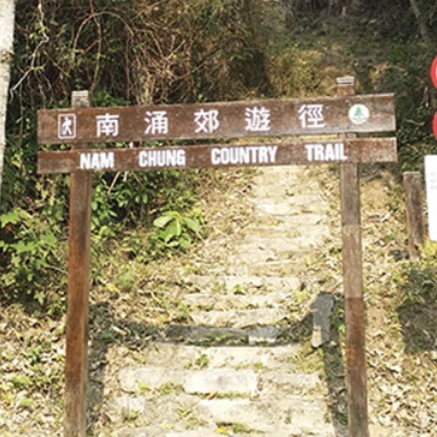
南涌郊遊徑
Nam Chung Country Trail
Points: 150
Map Location: View Map
The Nam Chung Country Trail starts at Nam Chung and ends at Danzhukeng. It passes through Guitouling, which is about 400 meters high. Although it is a difficult section, the scenery is varied. Nam Chung is one of the ancient villages in the New Territories, including Yeung Uk, Cheng Uk and Lo Uk. Not long after the intersection of Lo Uk, you will reach the starting point of the Nam Chung Country Trail. After climbing the mountain trail, you can clearly see the villages, farmlands and fish ponds in Luk Keng and Nam Chung, and you can also see Sha Tau Kok Sea and Sha Tau Kok in the distance. Before reaching Lao Lung Tin, there is a mountain trail that goes up along the Pingnan Stone Stream.
沙螺洞保育中心
Sha Lo Tung Environmental Education Centre
Points: 75
Map Location: View Map
Sha Lo Tung is located in the northern New Territories and surrounded by Pat Sin Leng Country Park. Its major habitats include freshwater stream, seasonal wetland, abandoned farmland and Fung Shui Woodland. The streams in Sha Lo Tung and its marsh on the northeastern part belong to Site of Special Scientific Interest and it is regarded as the second Priority Sites for Enhanced Conservation, just after Mai Po. Funded environmental groups to set up a conservation centre in Sha Lo Tung to carry out conservation work.
衞奕信徑9段(近屏風山)
Wilson Trail Section 9 (near Ping Fung Hill)
Points: 100
Map Location: View Map
Ping Fung Hill is located at the junction of Tai Po District and North District, with an altitude of 529 meters. The surrounding area is included in the Pat Sin Leng Country Park.
Event Information:
- Free to attend the event (five stations)
- Event Date 1/8/2025 – 28/2/2026
- The event features a fun day where participants can try out the game together. We will also arrange a cheer up station for everyone at the starting point!
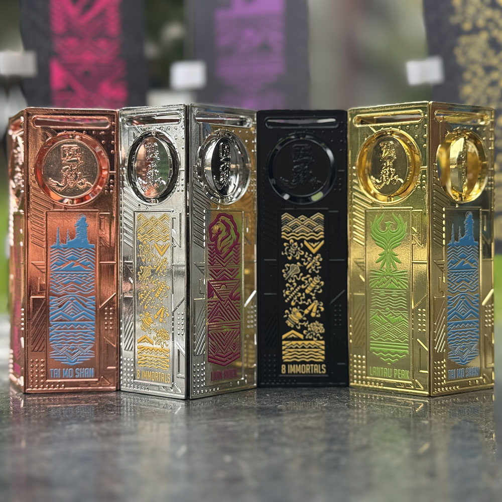
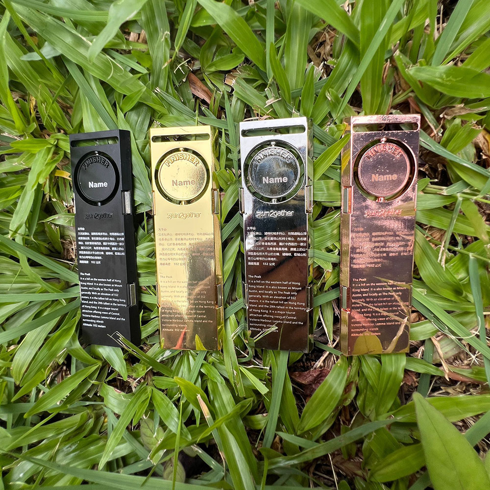
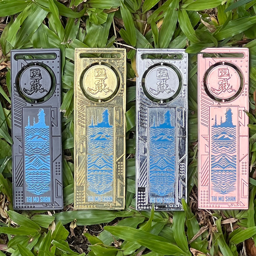
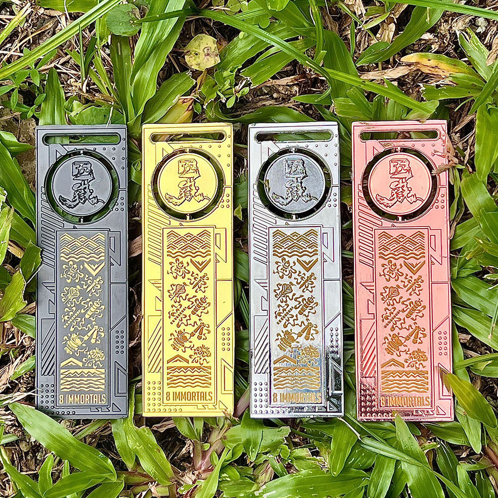
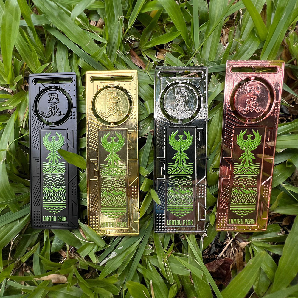
Completion Medals:
A set of five completion medals, includes the wooden base and the flashing light cover assembly. (need to be purchased separately, but if you fail to complete a particular station, you will not be awarded a completion medal for that station)
Completion medals will be divided into four levels:
- Bronze (less than 500 points per station)
- Silver (Station 500 – 999 points)
- Gold (1000 points – 1199 points)
- Elite (1200 points or more)
Each medal level will be determined based on the score of each station.
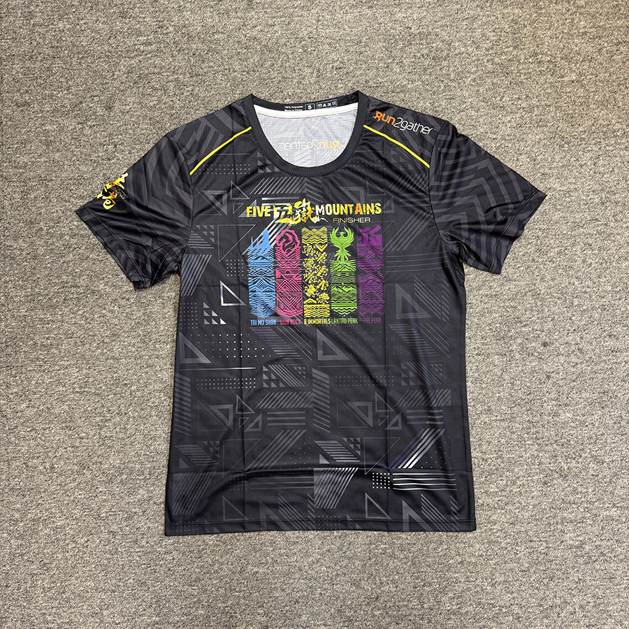
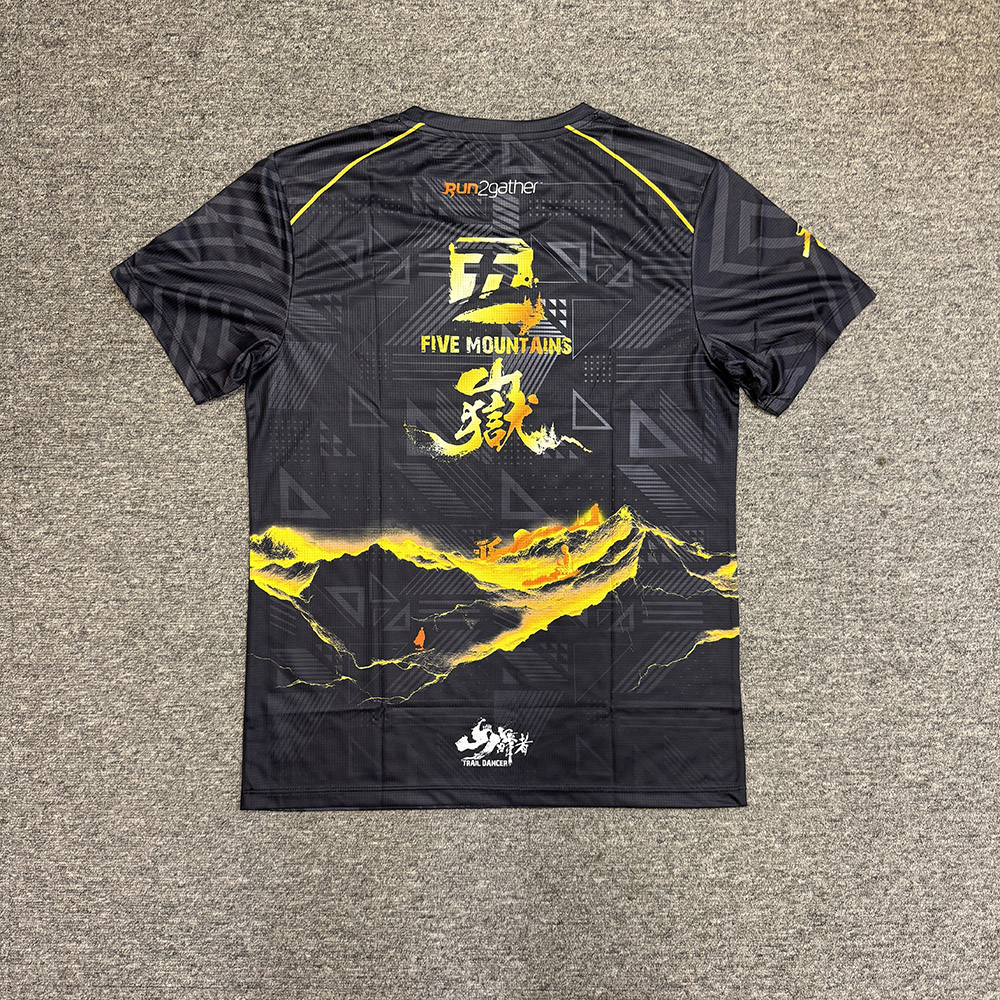
Finisher T-shirts:
There will be three levels of finisher T-shirts:
- Blue (total score of five stations is below 5000 points)
- Red (Total score of five stations is 5000 points to 5999 points)
- Black (Total score of five stations is 6000 points or above)
Challenge Completion Rewards
- Gone Running $100 Shopping Voucher
- Run2gather $50 Shopping Voucher
Free gift for participant

Add-on Products
Complete Set of 5 Finisher Medals: HK$400.00 (The medal color you receive will depend on your score on the assigned tasks, with medal colors awarded based on the distribution of scores.)
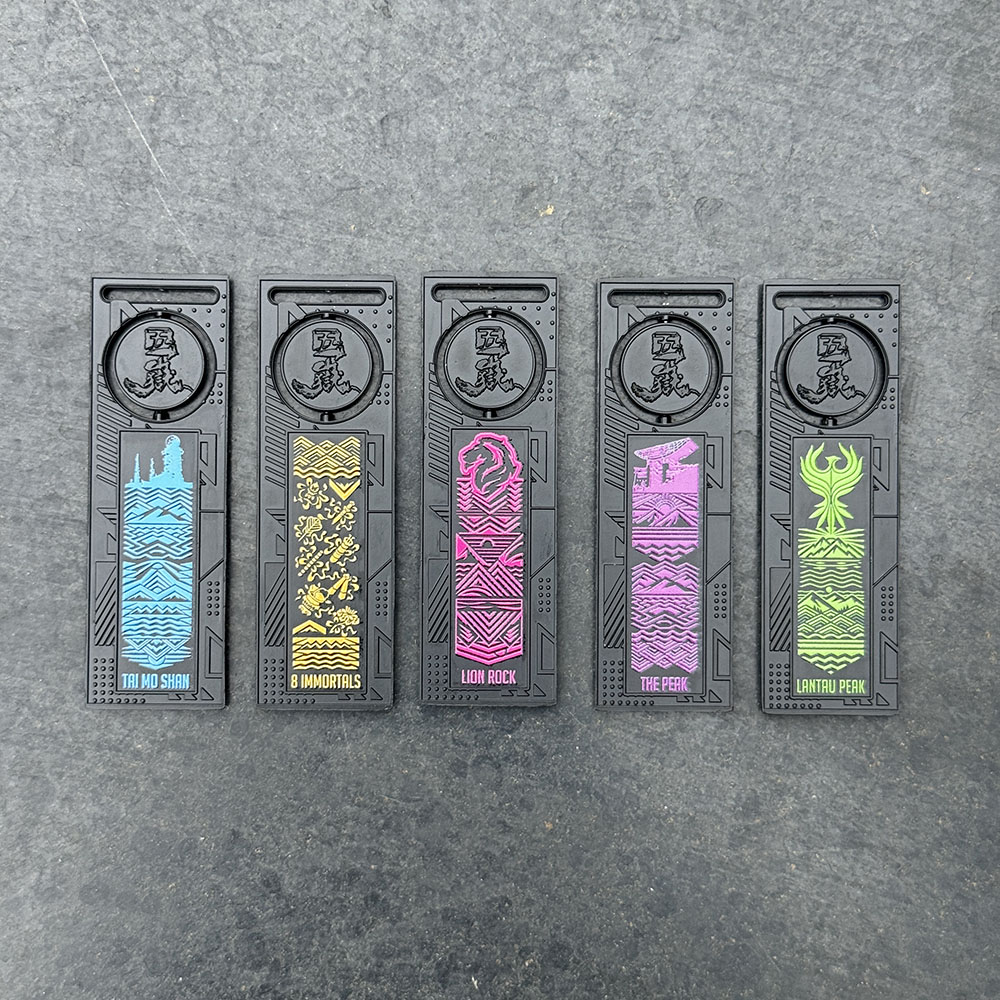
Finisher Medal (Single Stage): HK$70.00 (The medal color you receive will depend on your score on the assigned tasks, with medal colors awarded based on the distribution of scores.)

Finisher T-Shirt: HK$198.00 (You need to complete the assigned tasks to be eligible. The medal color will be assigned based on the score you obtain)
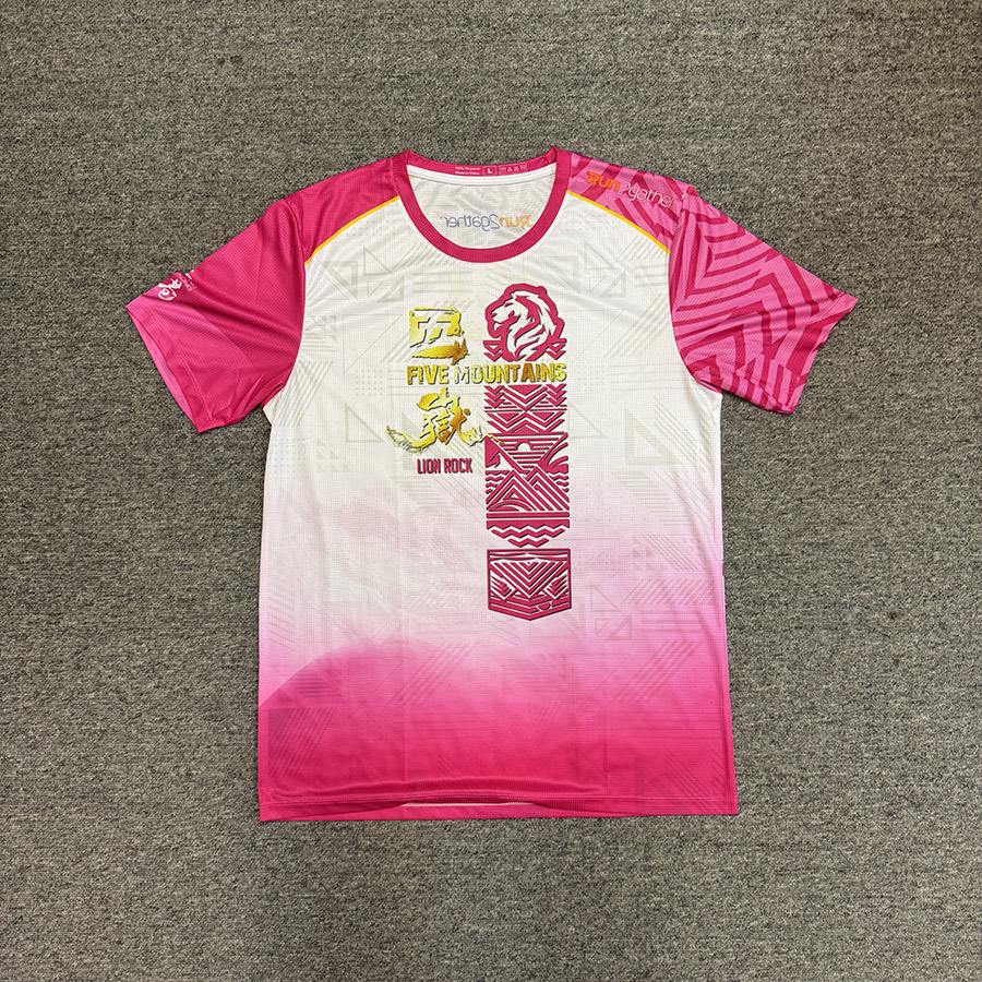
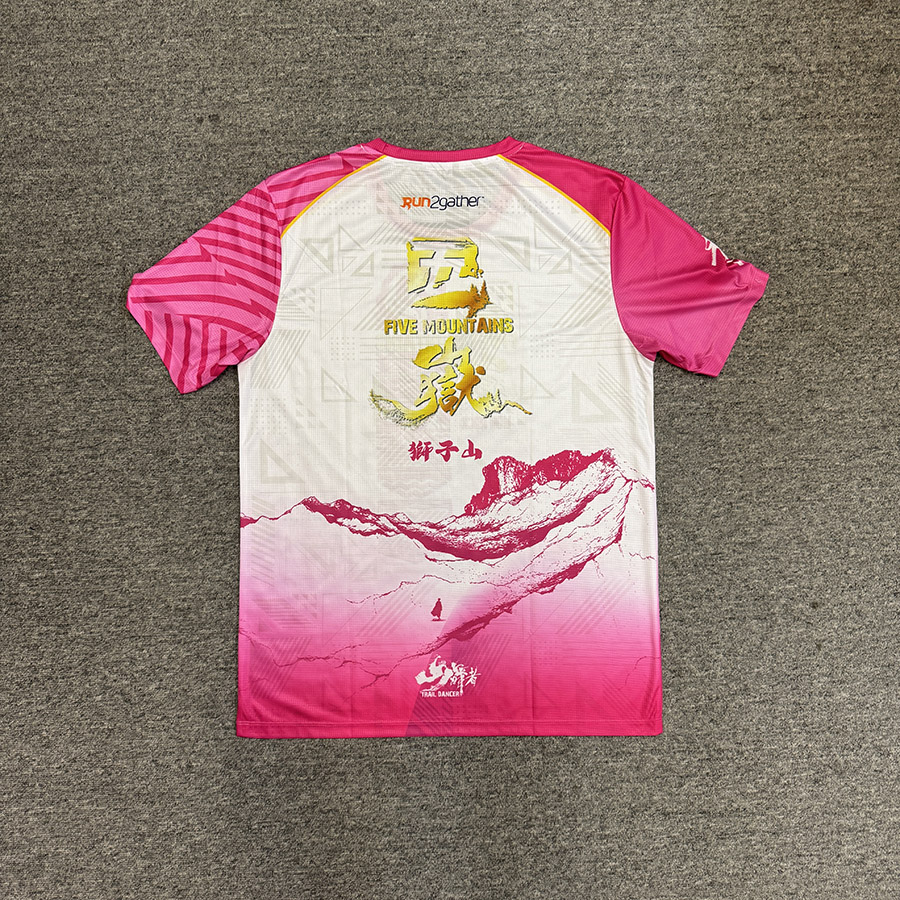
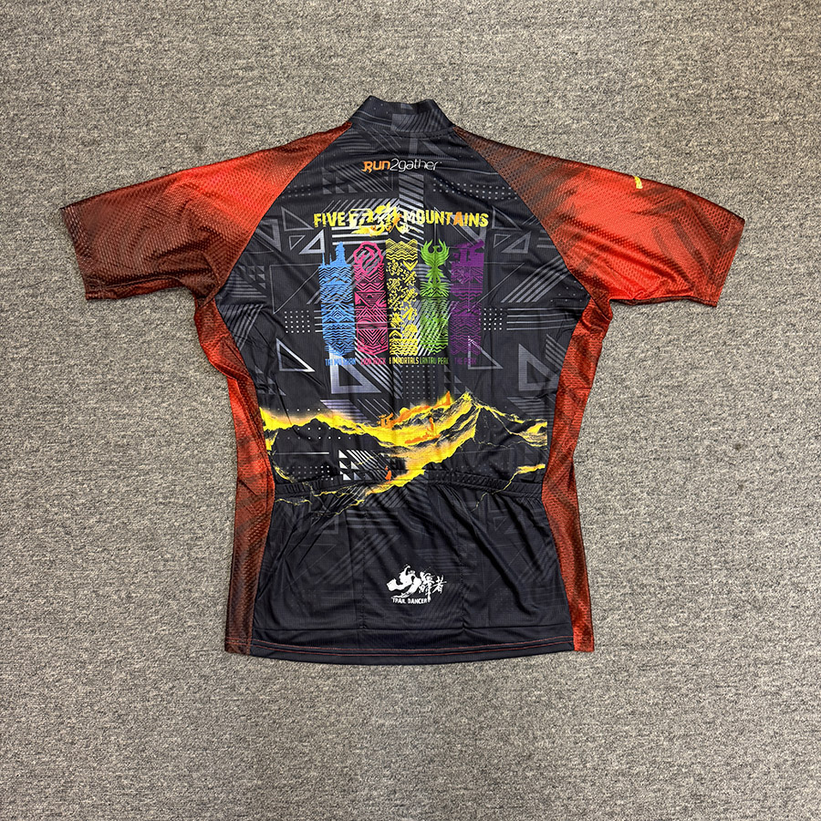
Event T-Shirt - Lion Rock: HK$168.00
Arrange for pickup or delivery within about one month after purchase.
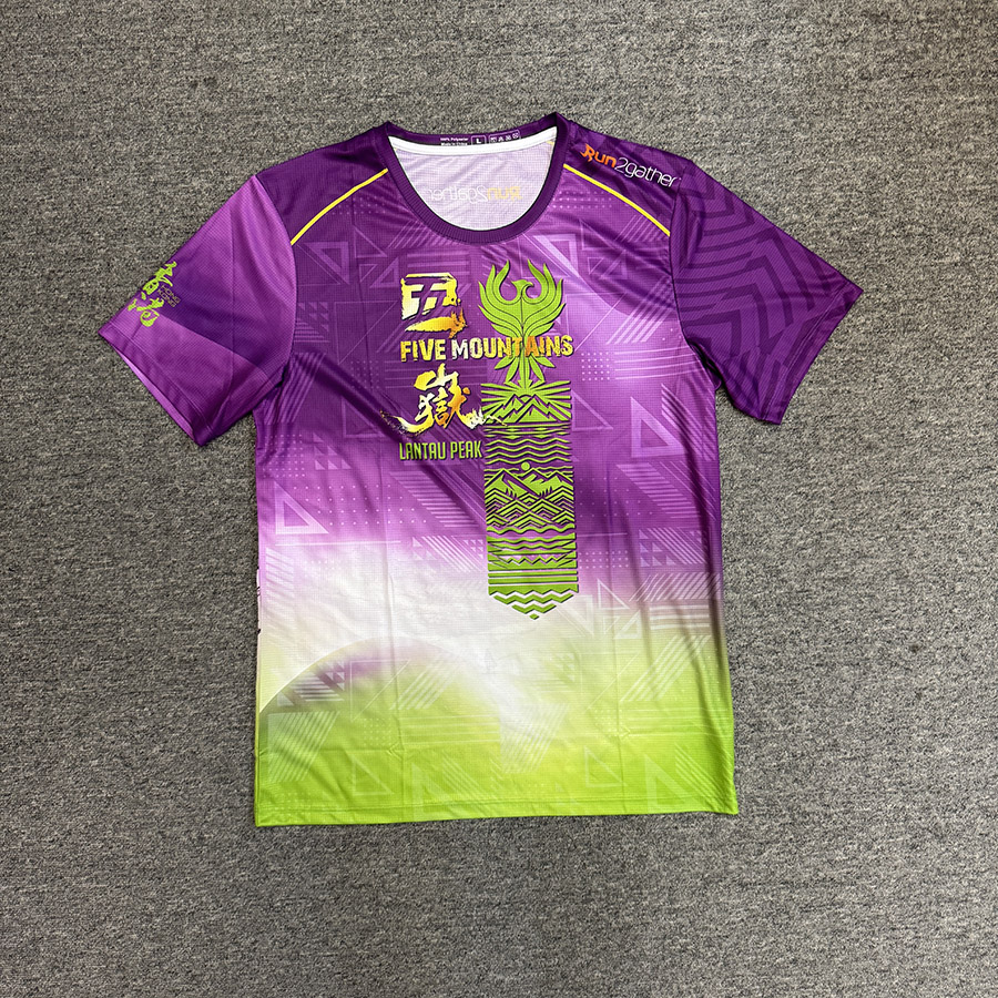
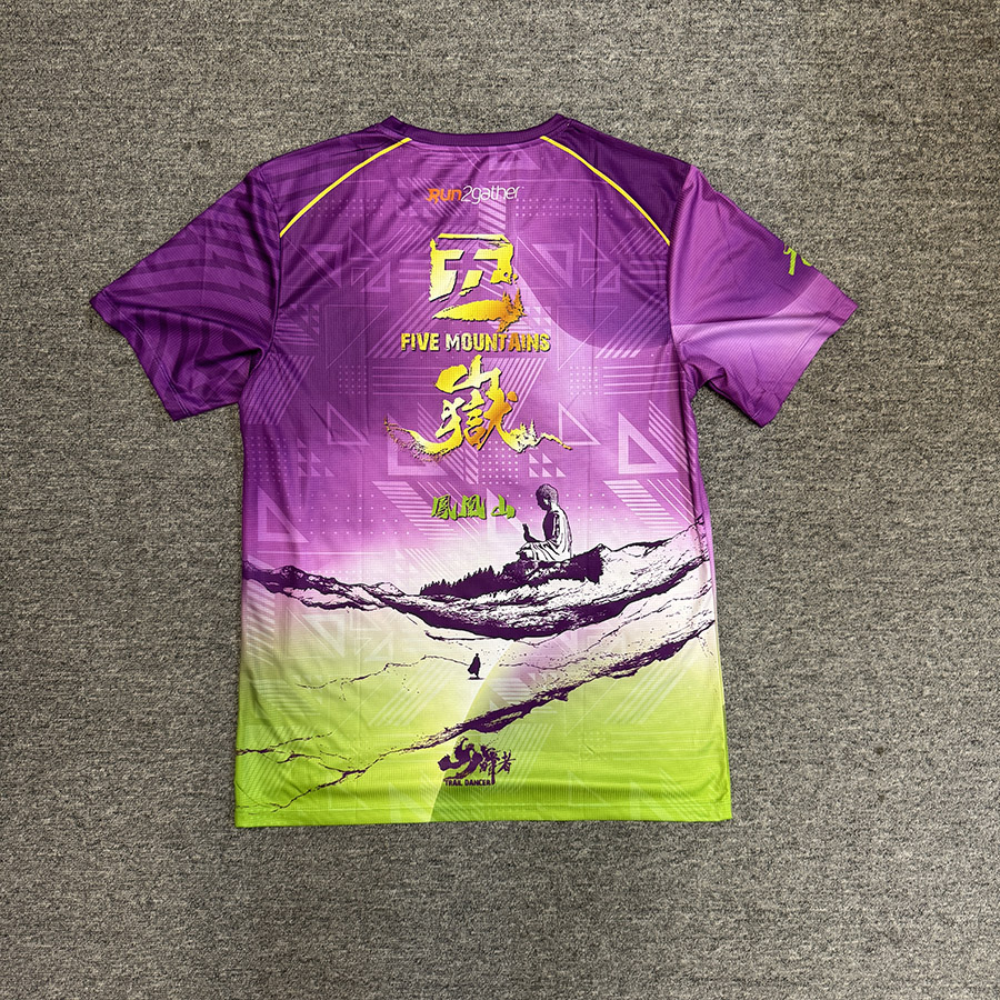
Event T-Shirt - Lantau Peak: HK$168.00
Arrange for pickup or delivery within about one month after purchase.
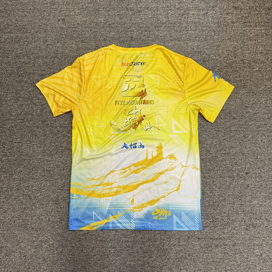
Event T-Shirt - Tai Mo Shan: HK$168.00
Arrange for pickup or delivery within about one month after purchase.
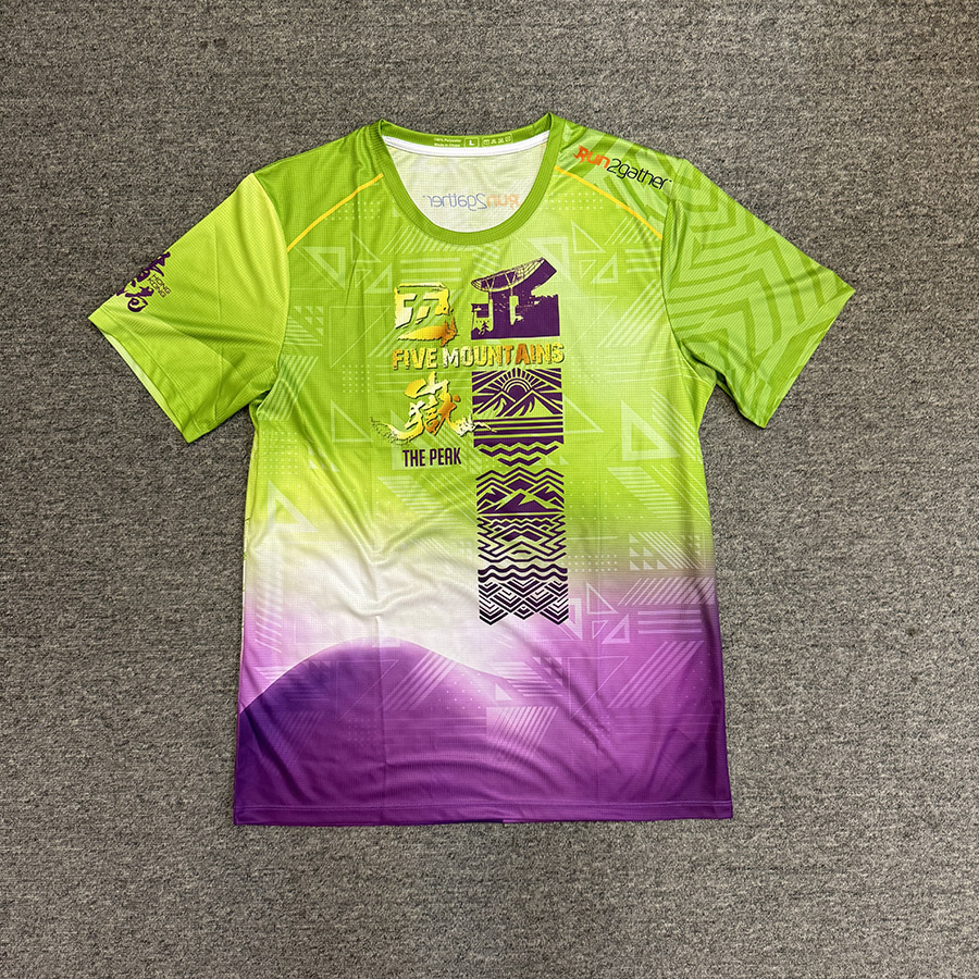
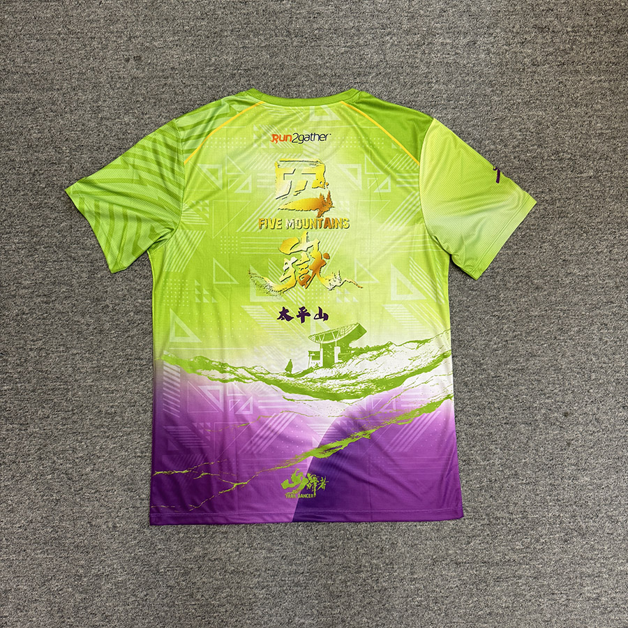
Event T-Shirt - Victoria Peak: HK$168.00
Arrange for pickup or delivery within about one month after purchase.
Event T-Shirt - Pat Sin Leng: HK$168.00
Arrange for pickup or delivery within about one month after purchase.
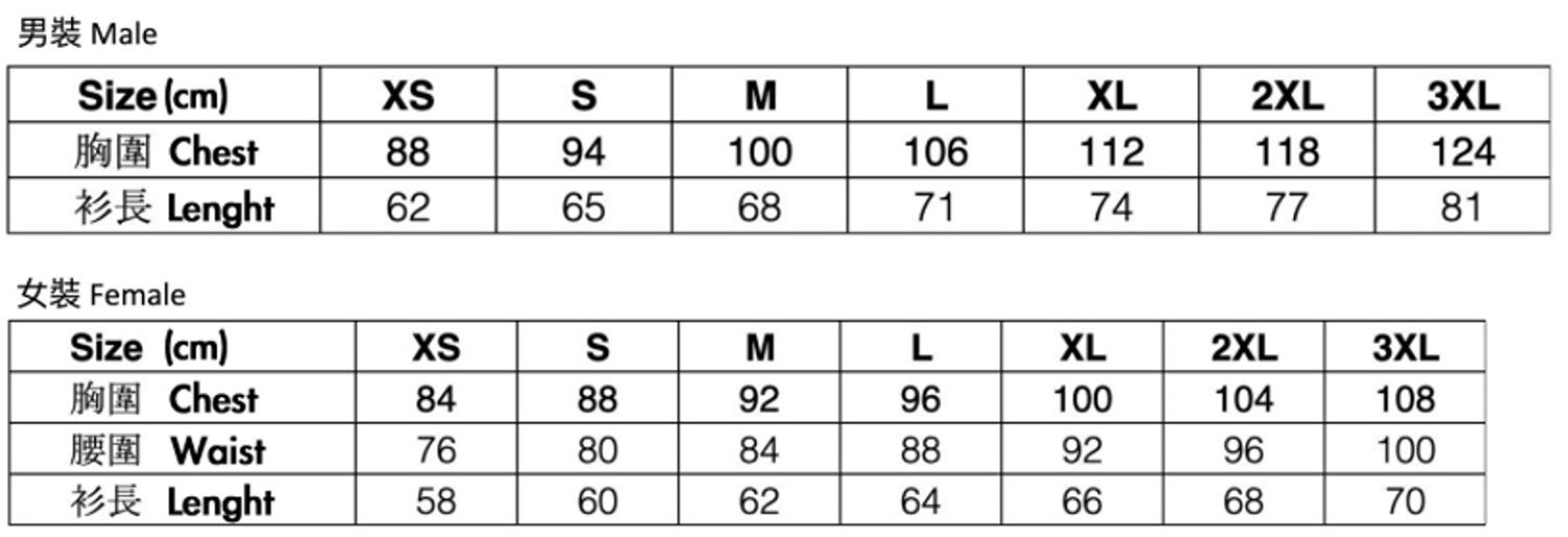
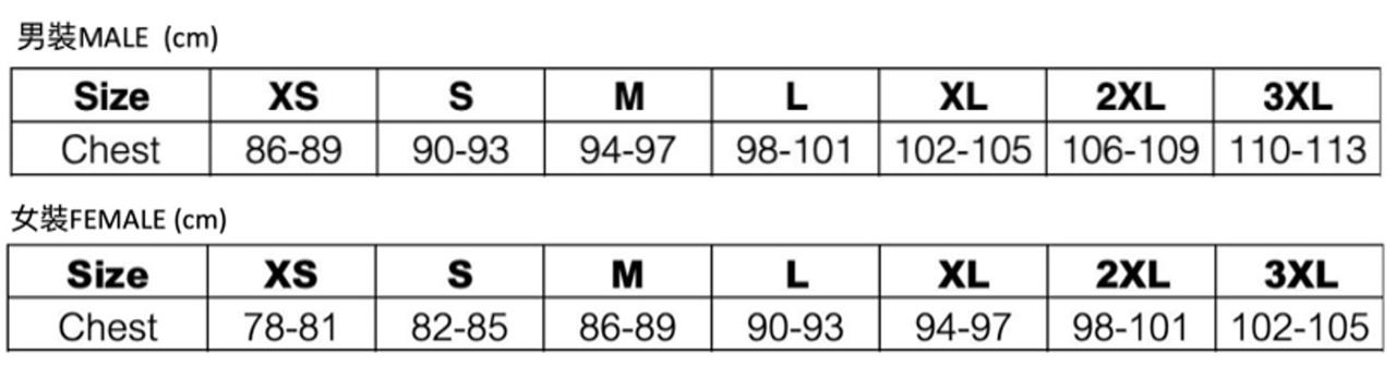
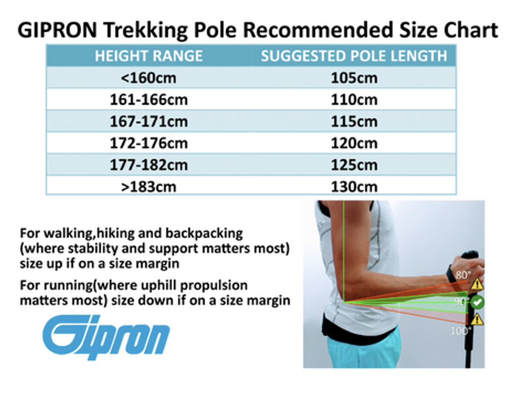
Tee size chart
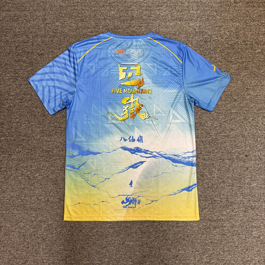
Five Peaks Trail Running Tee : HK$380.00
Arrange for pickup or delivery within about one month after purchase.
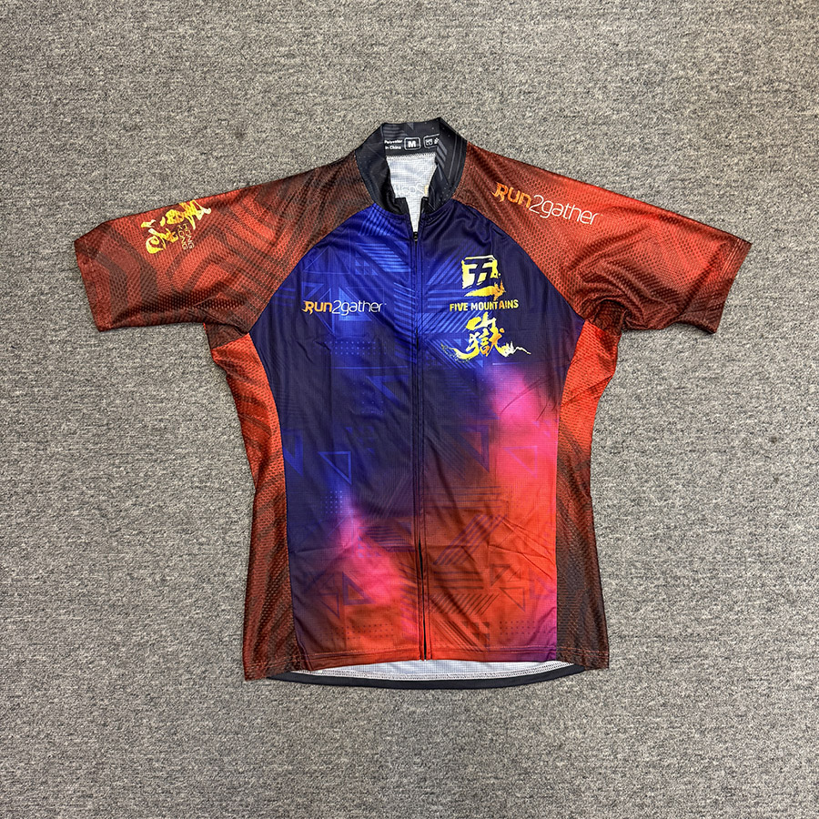
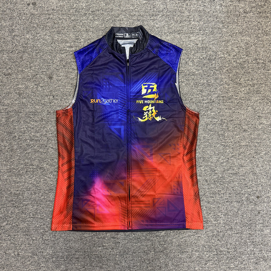
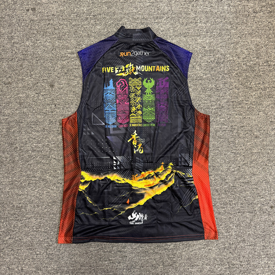
Five Peaks Trail Running (Vest Version): HK$380.00
Arrange for pickup or delivery within about one month after purchase.
HiFuture Flagship Dual-Core CPU Smartwatch : HK$980.00

- 1.43吋AMOLED顯示屏
- 雙頻 GPS
- 氣壓高度計
- 雙核心CPU
- 內建指南針
- 平滑的觸摸反應
- 無線通話
- 額外皮帶
- Syntra人工智慧技術
- 多個錶盤
- 100多種運動模式
- 5 ATM 防水
- 心率監測
- 睡眠品質分析
- 每日使用長達 10 天
HiFuture Mini Wearable Bluetooth Speaker: HK148.00

- 重量:77克,輕巧便攜,方便攜帶。
- 音效輸出:5W,提供清晰且強勁的音質,適合音樂和播客收聽。
- 電池續航:可持續播放8小時,適合長時間使用。
- 充電接口:Type-C 快速充電,充電高效便捷。
- 防水等級:IPX7,能抵抗水和灰塵的侵入,適合各種戶外活動。
- 連接技術:支援先進的藍牙 5.4 技術,確保穩定的無線連接和快速配對。
- 設計特色:三角形格子紋路設計,不僅美觀還提供良好的握持感。
- 附加功能:配備磁性夾,可以輕鬆固定在衣物、背包或自行車上,方便使用。
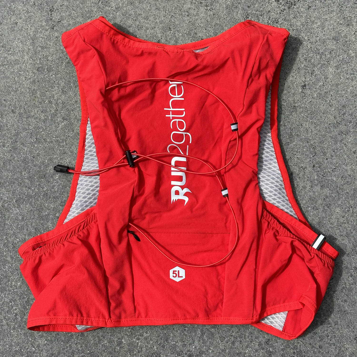
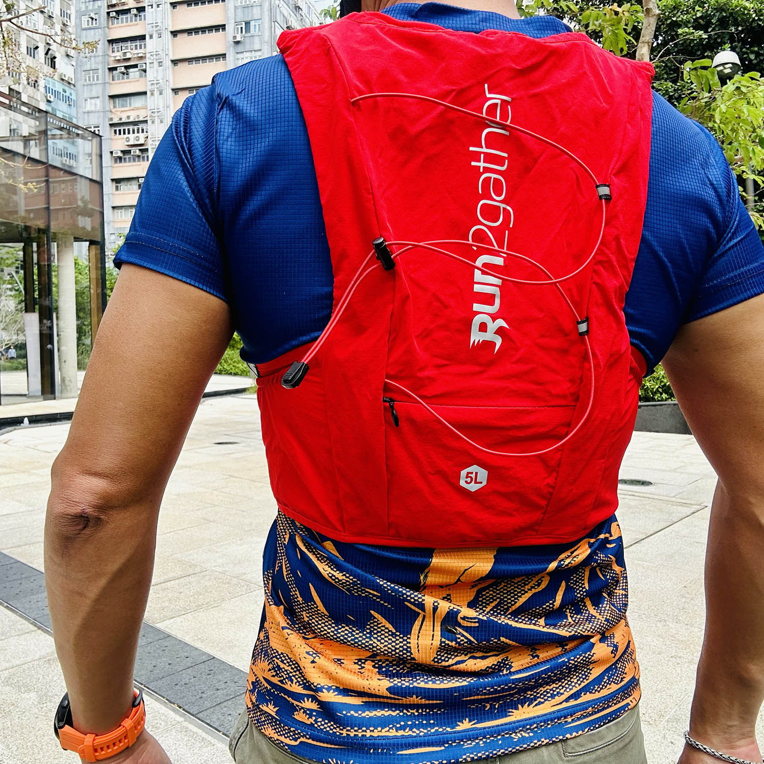
Run2gather Trail Running Backpack : HK150.00
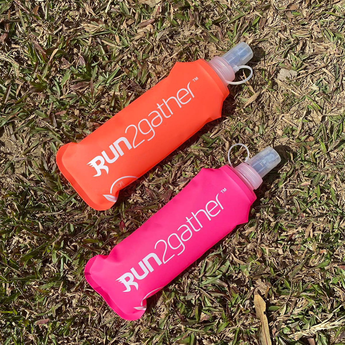
Run2gather Soft Flask 500ML : HK68.00
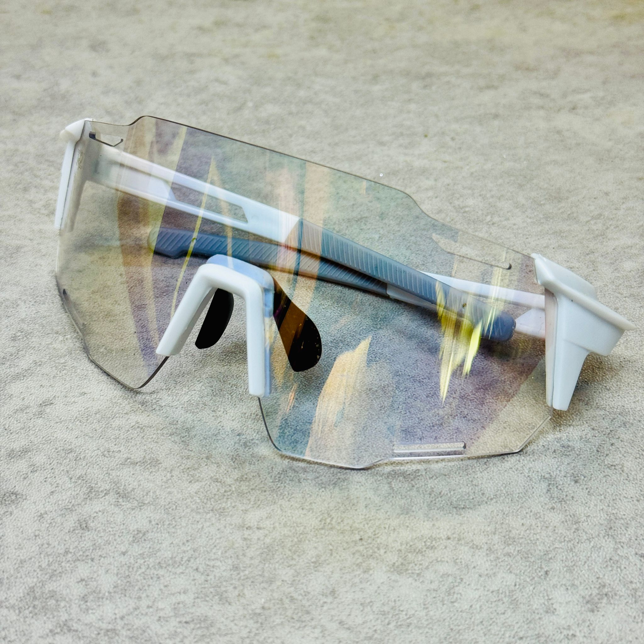
Run2gather Color Changing Sunglasses : HK$299.00

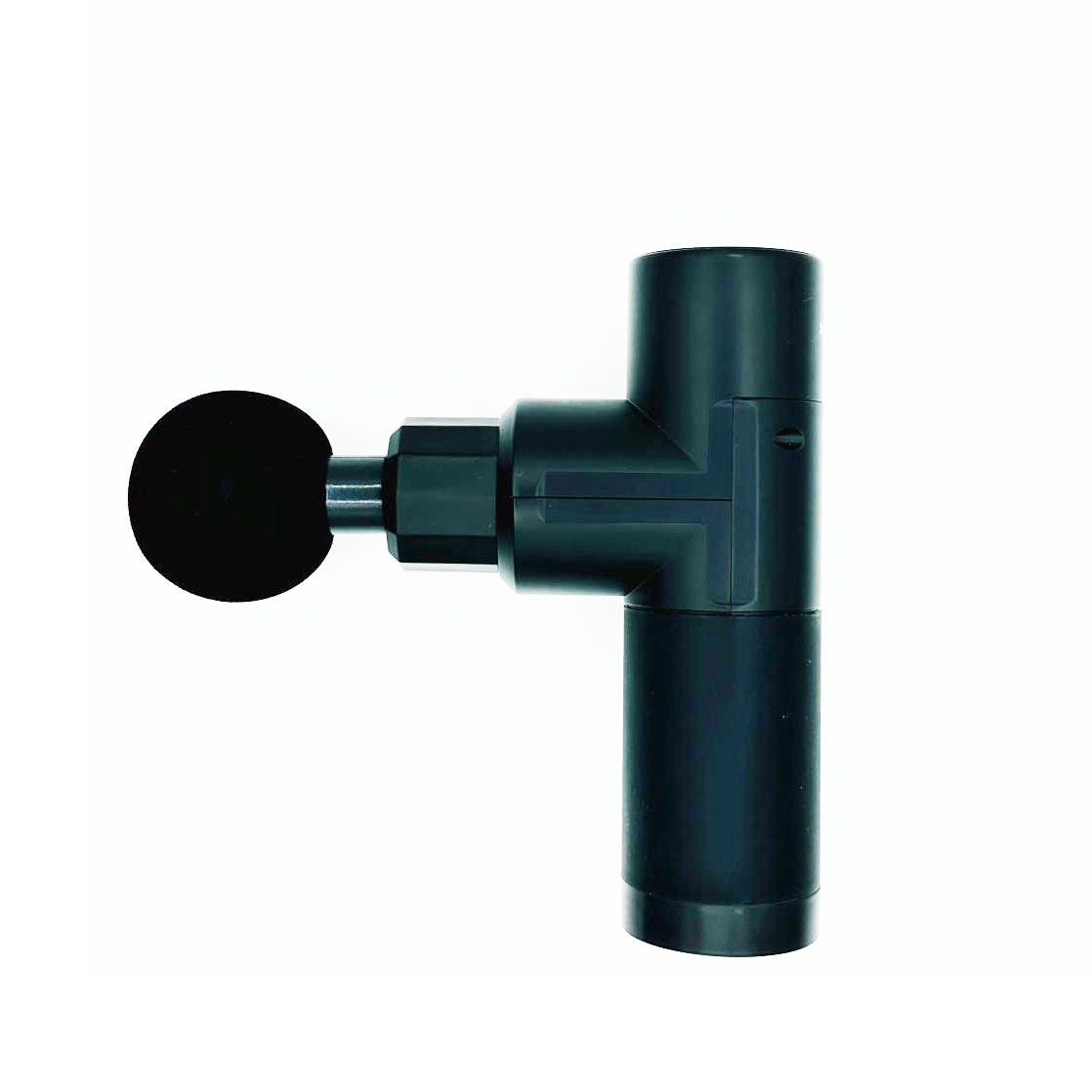
Run2gather Massage Gun : HK150.00

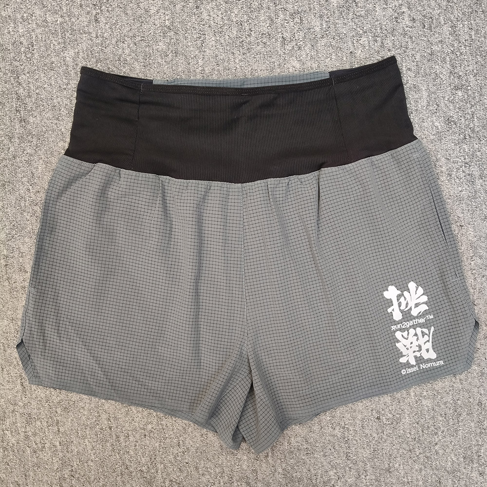
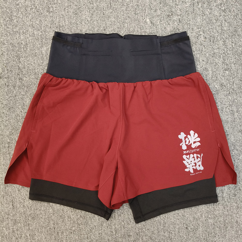
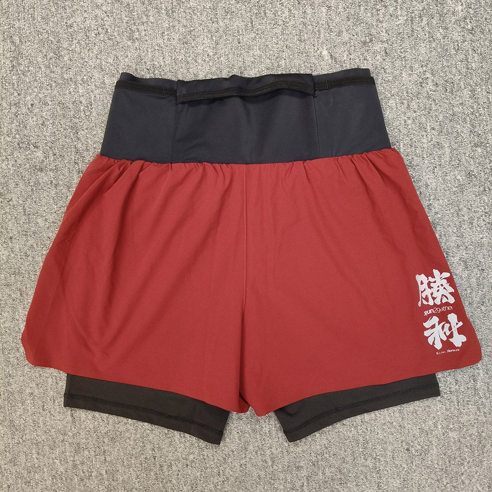
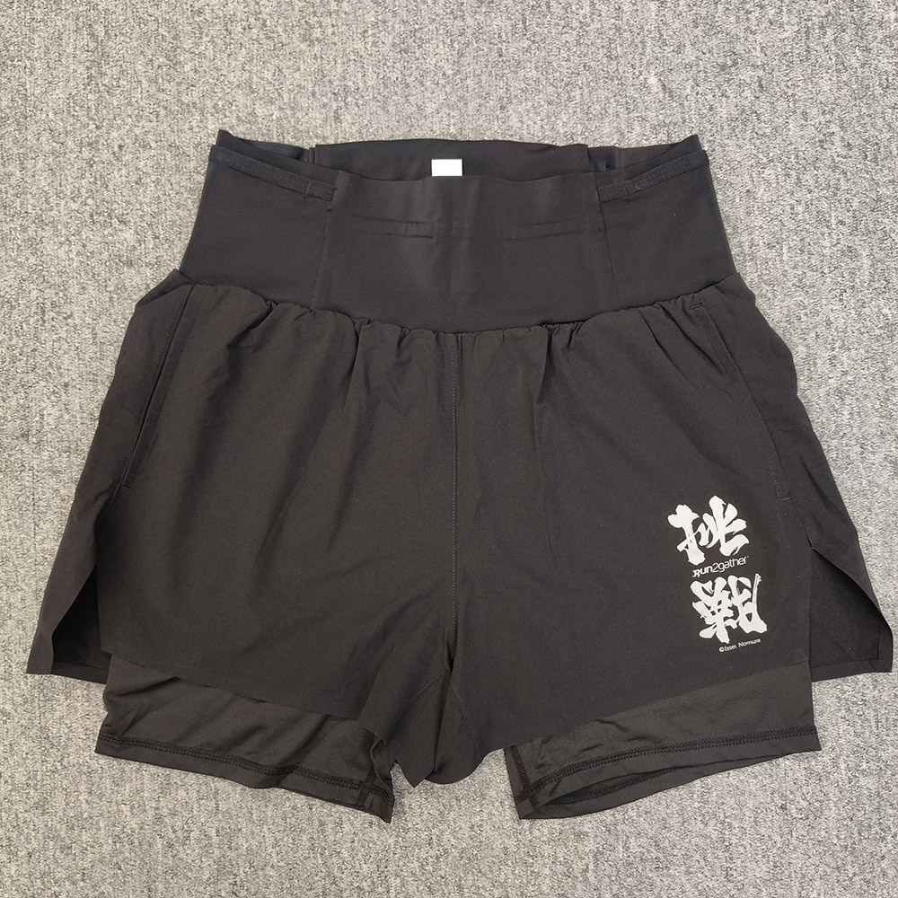
Running Shorts, $280
Gray
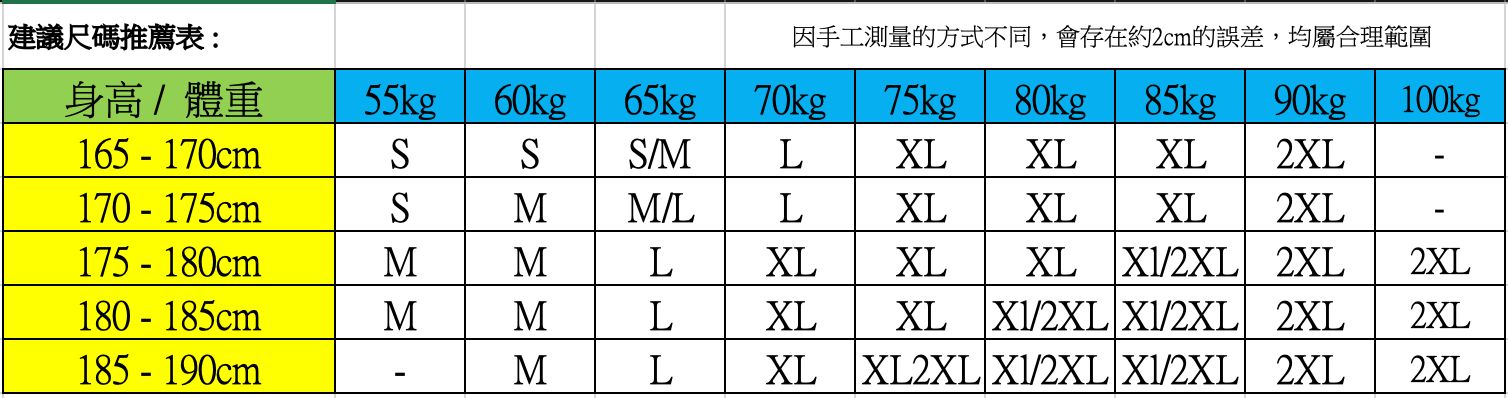
Running Shorts Size Chart
Altra Timp 5 (Men's Black Gray / Women's Blue Orange), HK$850
You will receive a notification email after purchase, and you can pick up at Gone Running.
Blue

Orange

Gipron Mont Blanc Pole, HK$799

Gipron Matrix Pole, HK$1,299

COROS PACE 3, HK$1,999

COROS PACE Pro, HK$2,899

COROS Vertix 2S, HK$5,599

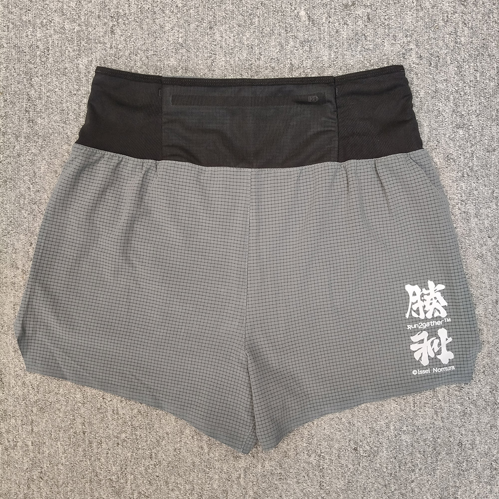
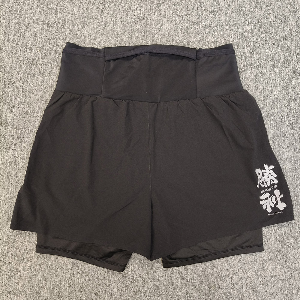
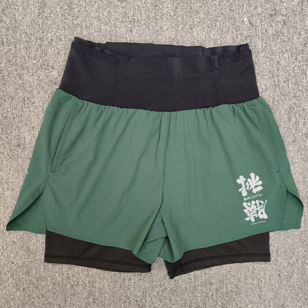
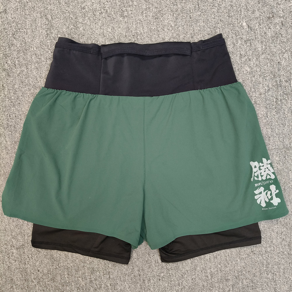
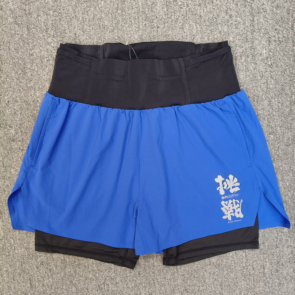
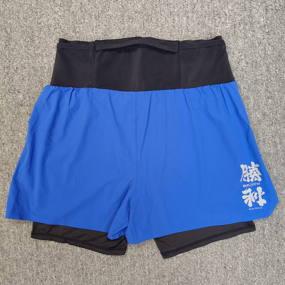
Trail Running Shorts, $280
Red
Black
Green
Light Blue
Trail Running Shorts Size Chart
Delivery and Pick-up arrangement
- Participant can choose (A) Deliver by SF Express, or (B) Self-collection at R2 designated Pick-up point, and it if free of charge.
- For choosing (A) Deliver by SF Express, Participant is required to pay the delivery charge upon receiving the pack. If choosing SF station/EF Locker as the delivery address, please fill-in the respective location code of the Station/ EF-Locker.
- Medals will be kept for 6 months and no replacement will be arranged thereafter if Participant failed to pick up the medal and finisher pack within the mandated period.
- Please look up here for the location code of the Station/ EF-Locker.
Rules
Participant must use the Apps designated by Run2gather to record the running record and Upload the record or screen capture to Run2gather’s website; R2 will disqualify for who failed to upload within the mandated period or the uploaded distance is insufficient. Participant must use the Apps designated by Run2gather to record the running record Press here for designated or approved Apps.- Complete your race distance with one or more running session (before 31 Jan 2025)
- Upload the running record onto Run2gather’s website (before 1 Feb 2025)
- Completion Award: Medal & Completion Certificate (around 10 Feb 2025)
- Engraving Text on Medal
- Non-refundable and non-transferable of race quota
- "No award for unfinish participant". Furthermore, online run is a self-discipline game, Run2gather will check the uploaded running record regularly. R2 will exercise its discretion to disqualify the participate and/ or suspend the User account if ingenuine record is identified.
- Deliver Medal & arrange Self-pickup (around the end-Feb 2025 to the mid-Mar 2025)
Event Sponsor